Miscellaneous Monmouth Beach
Maps, letters, flyers, pictures, stories, ads, documents, signs, odd and unusual images of Monmouth Beach.
I claim no ownership of the images — I just track them down and post them. Sources provided will be credited (and check back for regular updates):
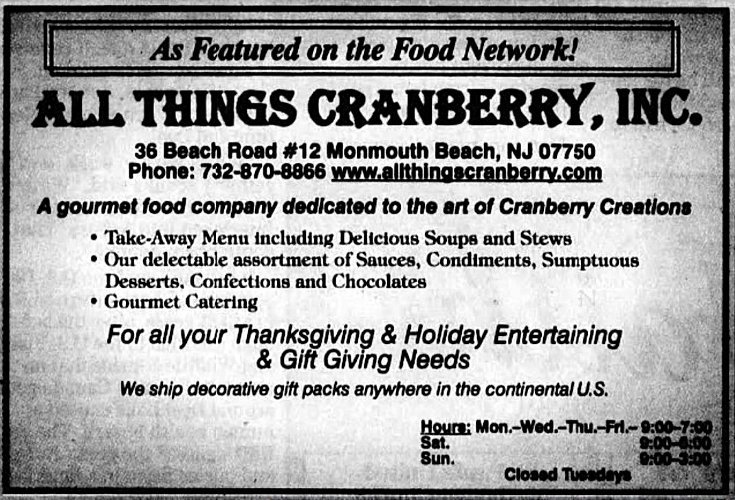
Berry Good — “All Things Cranberry” was a gourmet food store that operated in Monmouth Beach mini-mall, Asbury Park Press ad, December 2006. A former Wall Street banker, Clarisse Persanyi opened the shop in 2003.
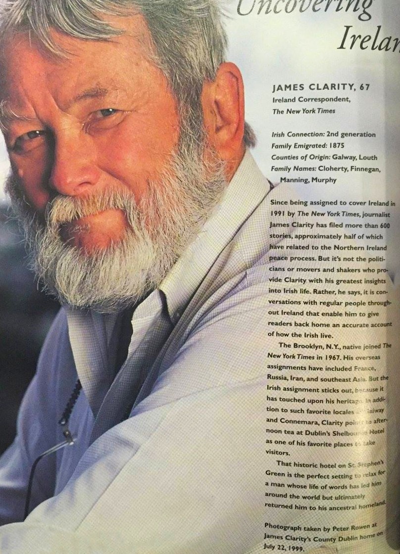
“Covering Ireland” — A quick Q&A with James F. Clarity, July 1999. A longtime Monmouth Beach resident and prominent New York Times journalist, he died in September 2007.

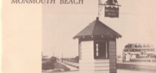
Cute old Monmouth Bach postcard, 1908.
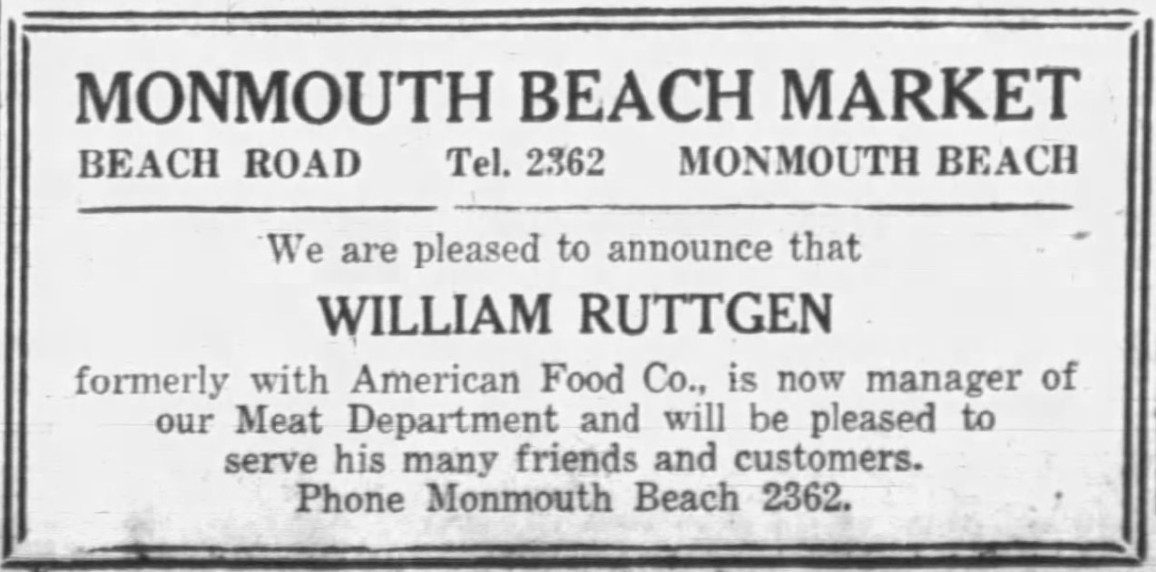
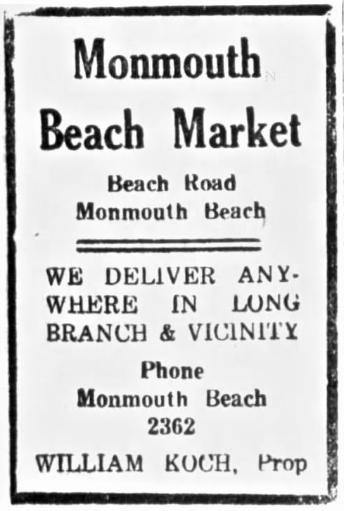
Who? — Monmouth Beach Market on Beach Road, Long Branch Daily Record, June 1928.
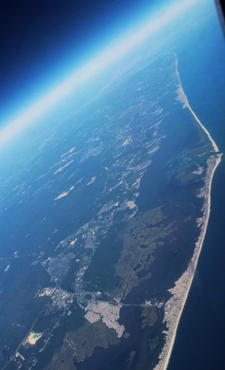
NJ Big Picture — Jersey Shore looking north — seen 35,000 feet, January 2024. “The full 125-mile NJ oceanfront represents three geomorphic types — a sand spit about 5 miles in length at the northern extremity; 24 miles of headland beach; and 96 miles of barrier beach,” History of New Jersey Coastline by C. F. Wicker, 1950 — MORE INFO.
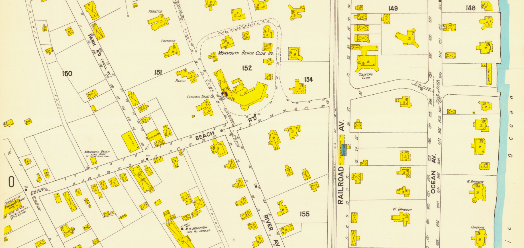
Guts of MB — Beach Road end-to-end, Sanborn Map, 1907
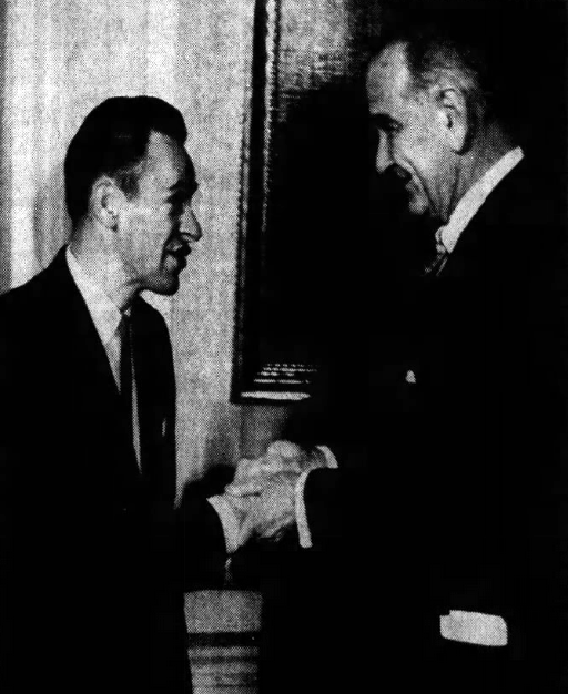
Right to the Top — Congressman-elect James J. Howard (l) is greeted by President Lyndon Johnson during a White House reception for new US House members, Long Branch Daily Record, December 1964.
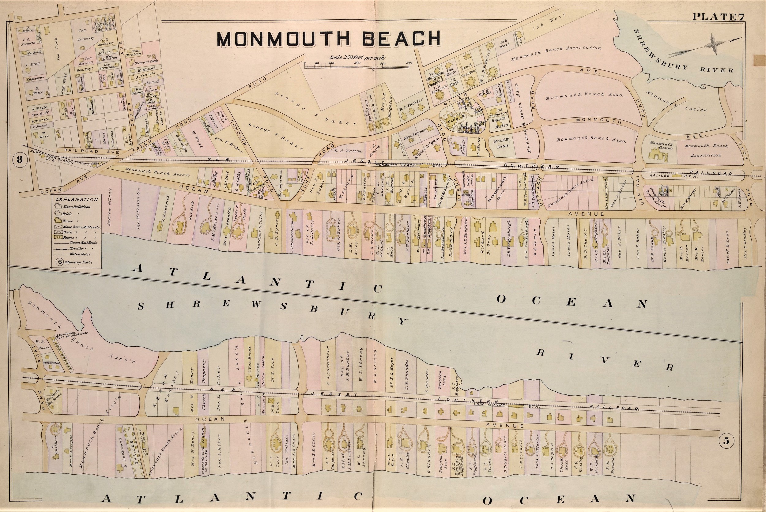
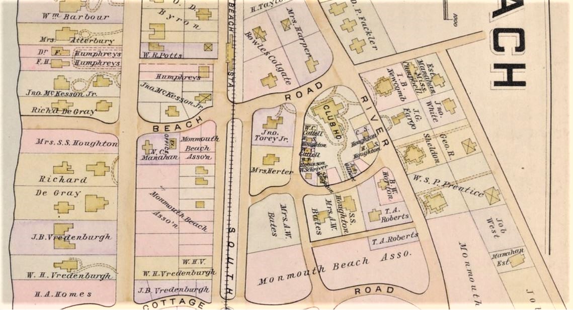
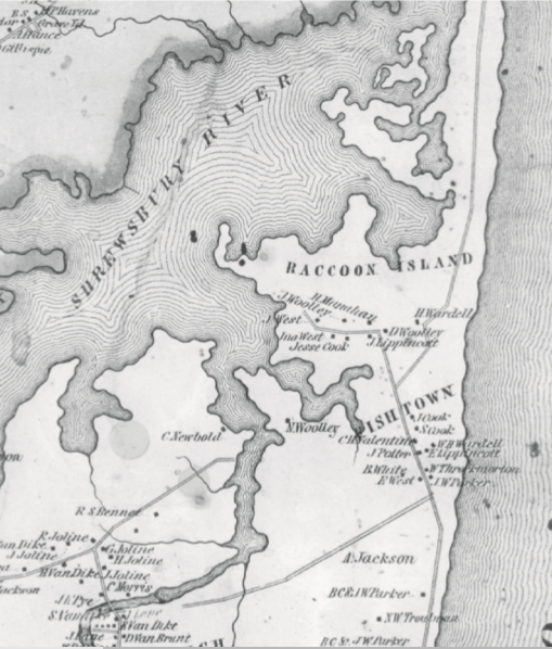
Map of Monmouth Beach — Wolverton’s Atlas of Monmouth County, NJ, 1889.
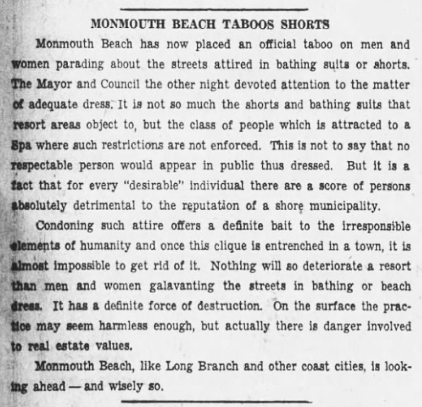
Madness in Monmouth Beach? A Long Branch Daily Record editorial from a different age, August 1936.
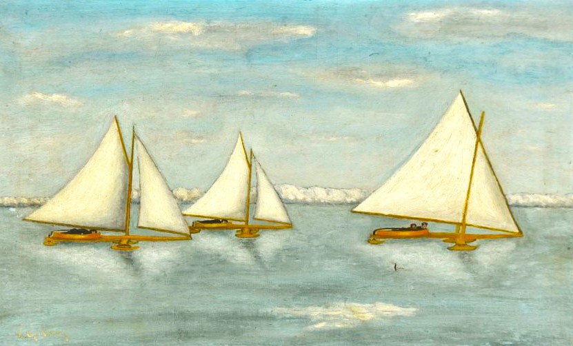
“Ice Boating on the South Shrewsbury River” by Victor Gilsey, 1900

New Ocean Avenue — from The Shore Press, December 1893.
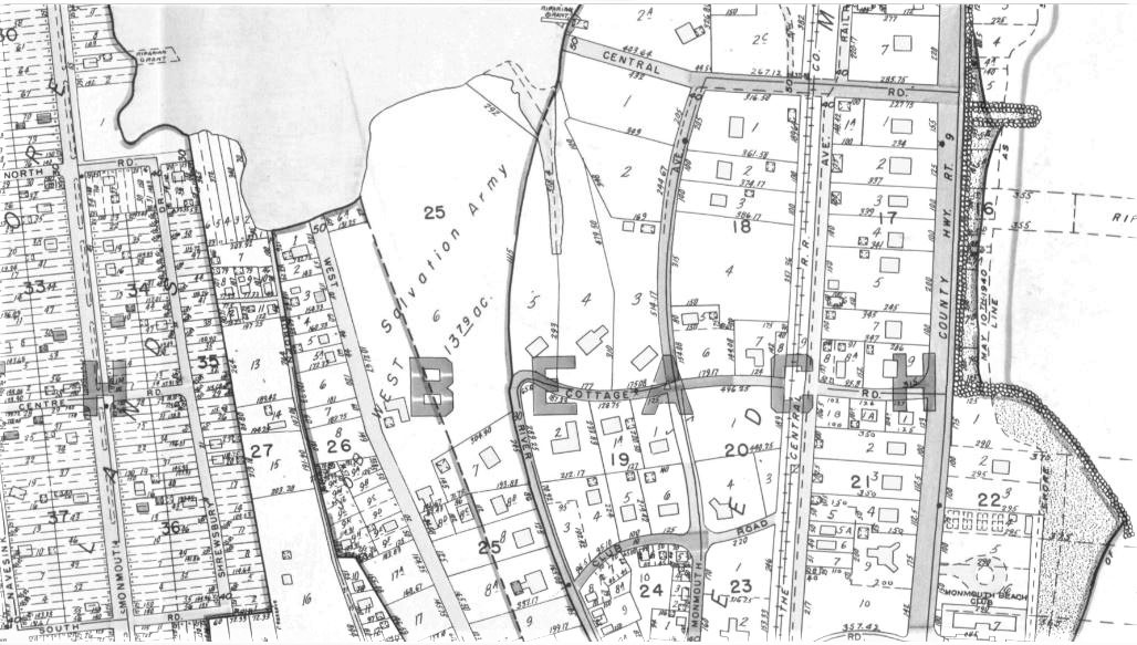
This map shows that the Salvation Army owned much of land along the borough’s north river shore. Land off West Street encompassing the Channel Club Tower, several marinas, and private homes — all the way to the river, Plat Book of Monmouth County, 1941. In July 1951, the Salvation Army sold all its property – called its “Home of Rest” for retired officers — which included 400-feet of river frontage.
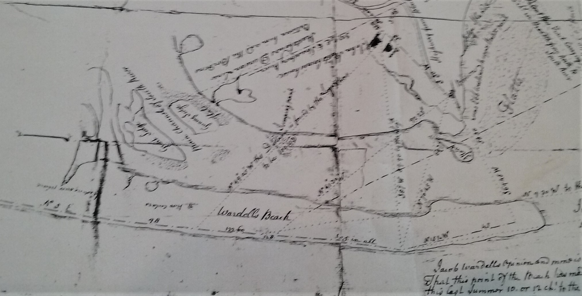
An ancient map showing “Wardell’s Beach” (now Monmouth Beach), 1764.

Shrewsbury Harbor Estates ad, 1974.
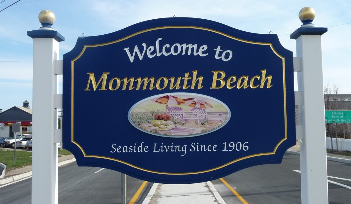
“Welcome to Monmouth Beach” southern border sign, 2018.

J. Walter Spalding — Death of a Sporting Goods Titian. Asbury Park Press, September 1931.
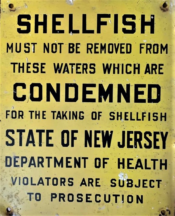
State sign posted on Monmouth Beach coast, 1960s.
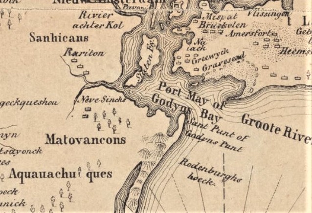
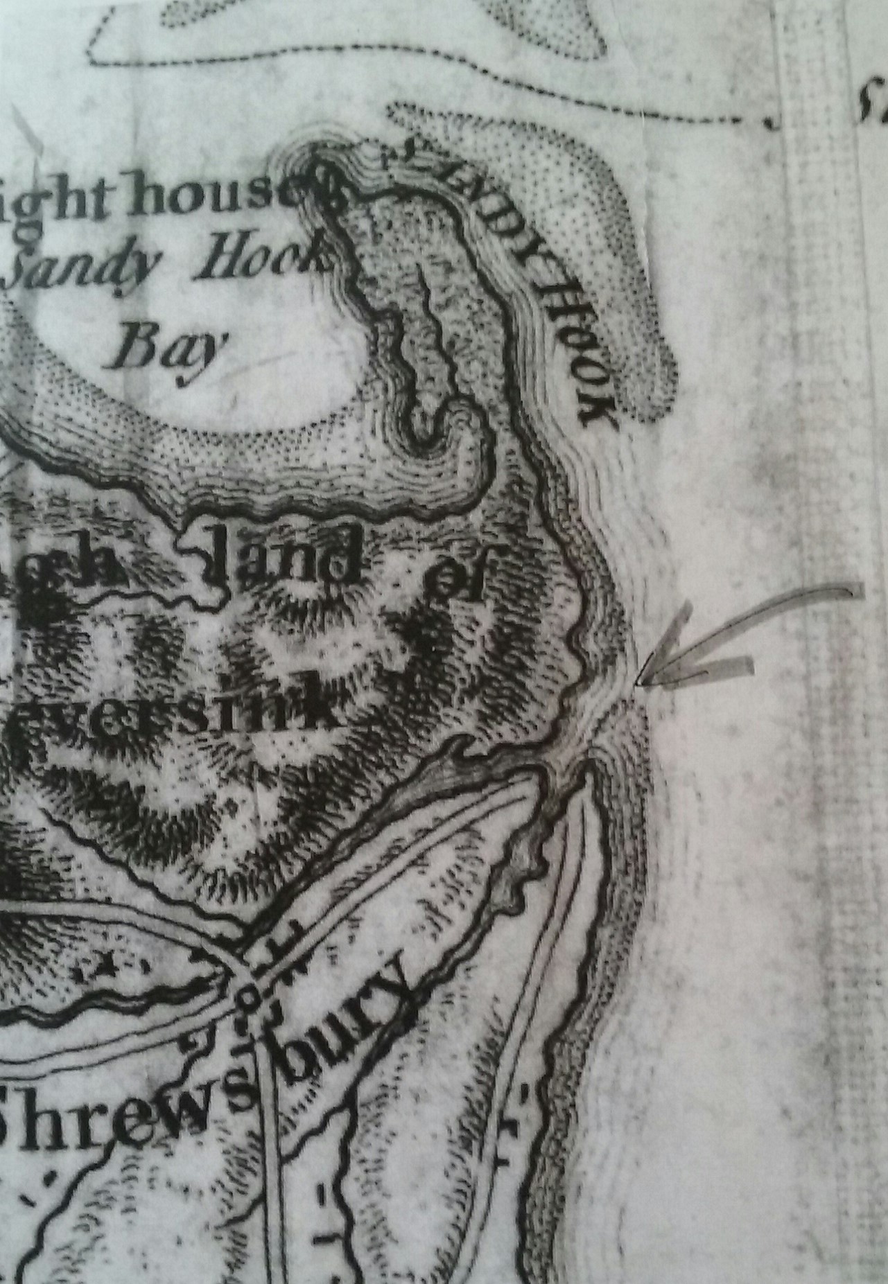
Adriaen van der Donck’s 1656 map of the Sandy Hook area (or New Netherland).
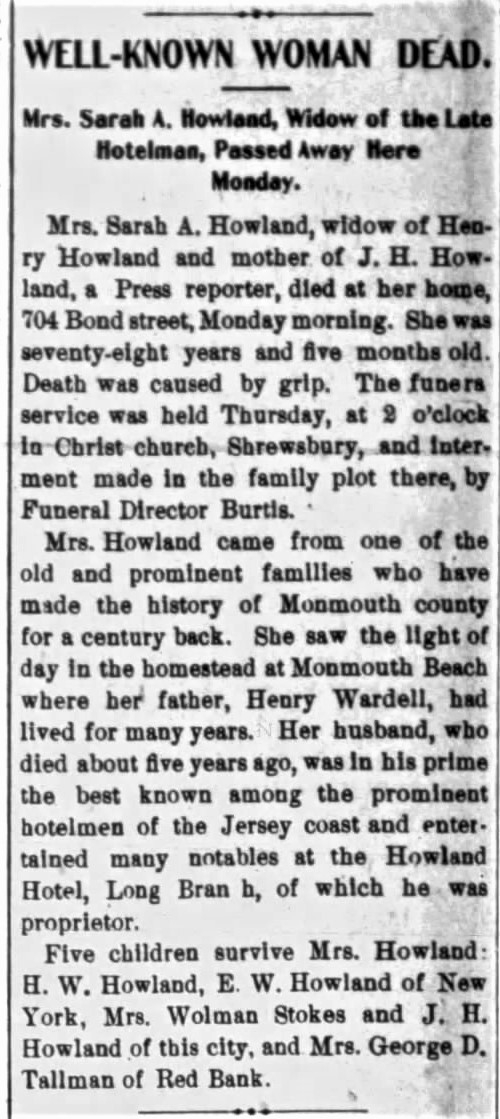
Sarah Howland obit. Asbury Journal, March 1901. With a neat Long Branch-Monmouth Beach connection.
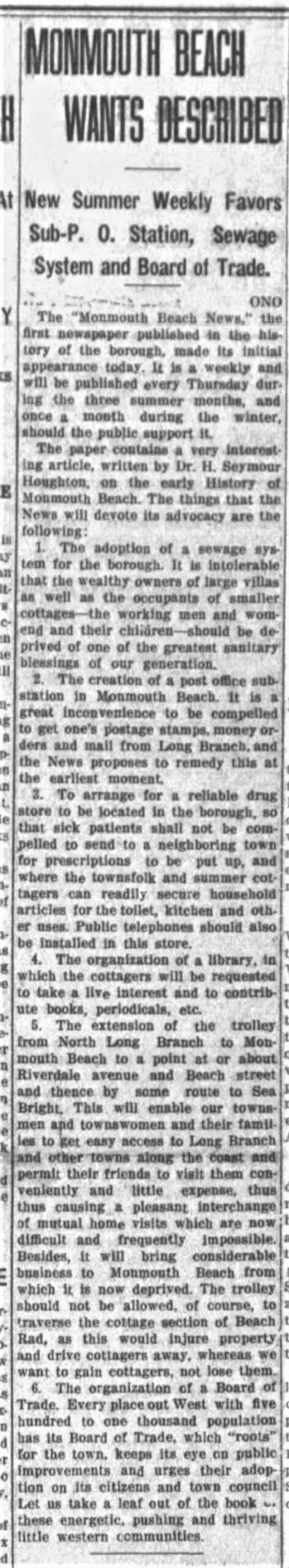
“Monmouth Beach News” launches. Long Branch Daily Record, July 1914
The December 1992 superstorm clobbered the borough and the surrounding shore area (Dawn Rise Photo).
Monmouth Beach Beginnings. Red Bank Register, March 1906.
Monmouth Beach Market ad, Long Branch Daily Record, August 1929.
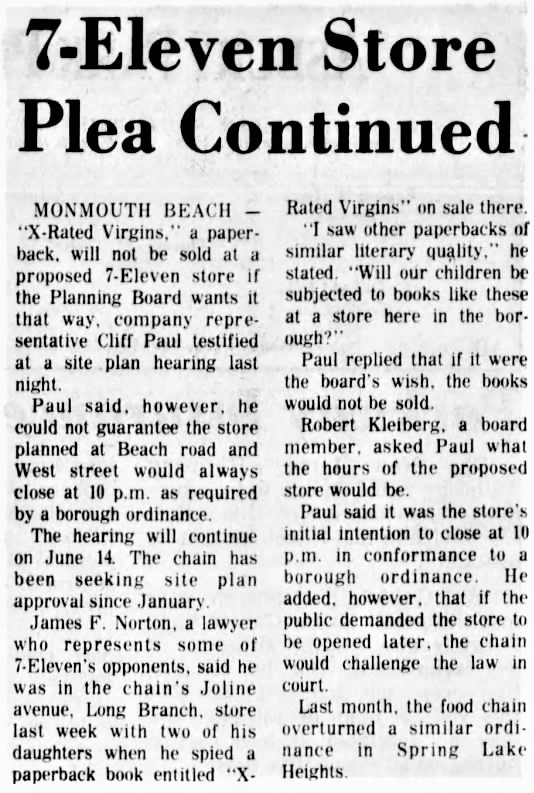
An Asbury Park Press story on a proposed convenience store on Beach Road. May 1976. The plan was ultimately withdrawn.
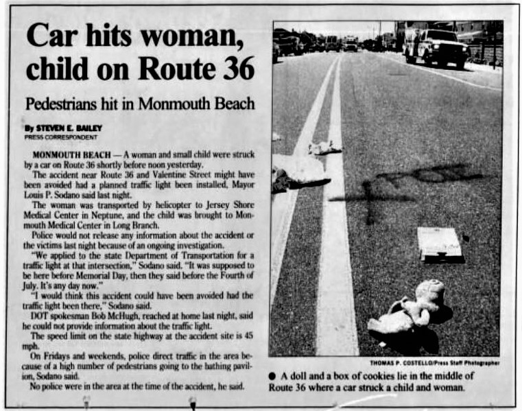
Asbury Park Press story, August 1995. Both accident victims, Mary Jo Monterio and her daughter Briana Noelle Allem of WLB, died. The driver was Anthony Indelicato of Union Beach.
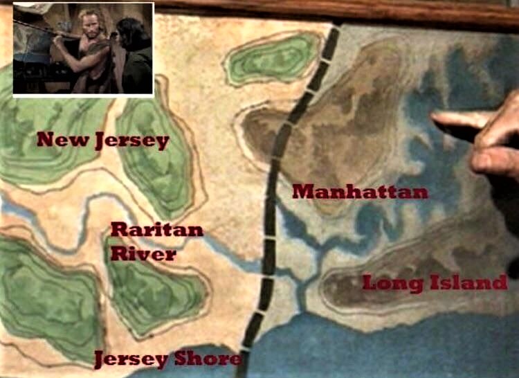
According to the 1968 classic sci-fi movie, Planet of the Apes, this map of the “Forbidden Zone” shows it’s area is NYC — while the Jersey Shore is the good neighborhood.
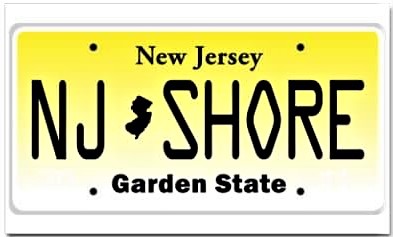
NJ Shore — Garden State license plate.
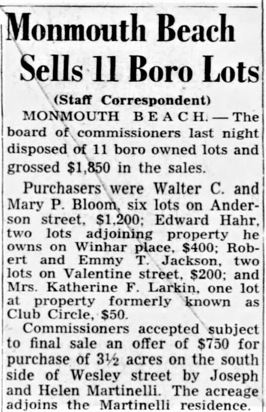
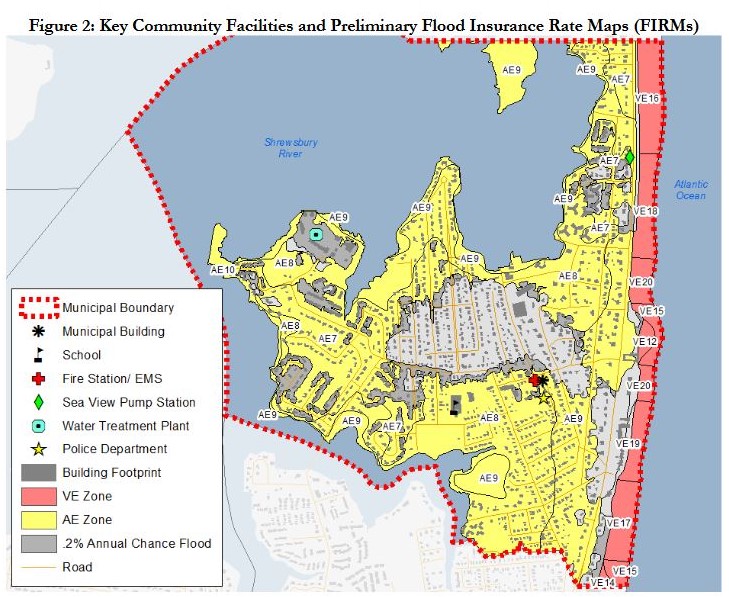
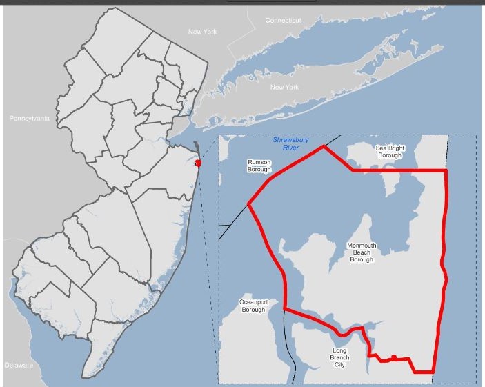
Map of Monmouth Beach, NJ, 2015. The first Monmouth Beach “Overseer of the Poor” (or Welfare Director) was John H. West who served from 1907 to 1916. A town native and fisherman, he was born in 1834. The next overseer was by Jesse V. Cook. Emmett Boyle, the tavern owner, was a longtime overseer. The office was responsible for administering relief to the poor within the community and still exists today.
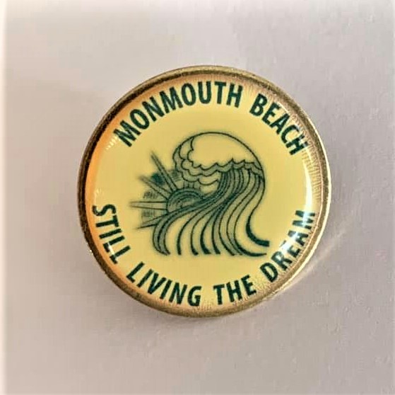
Monmouth Beach “Still living the dream”
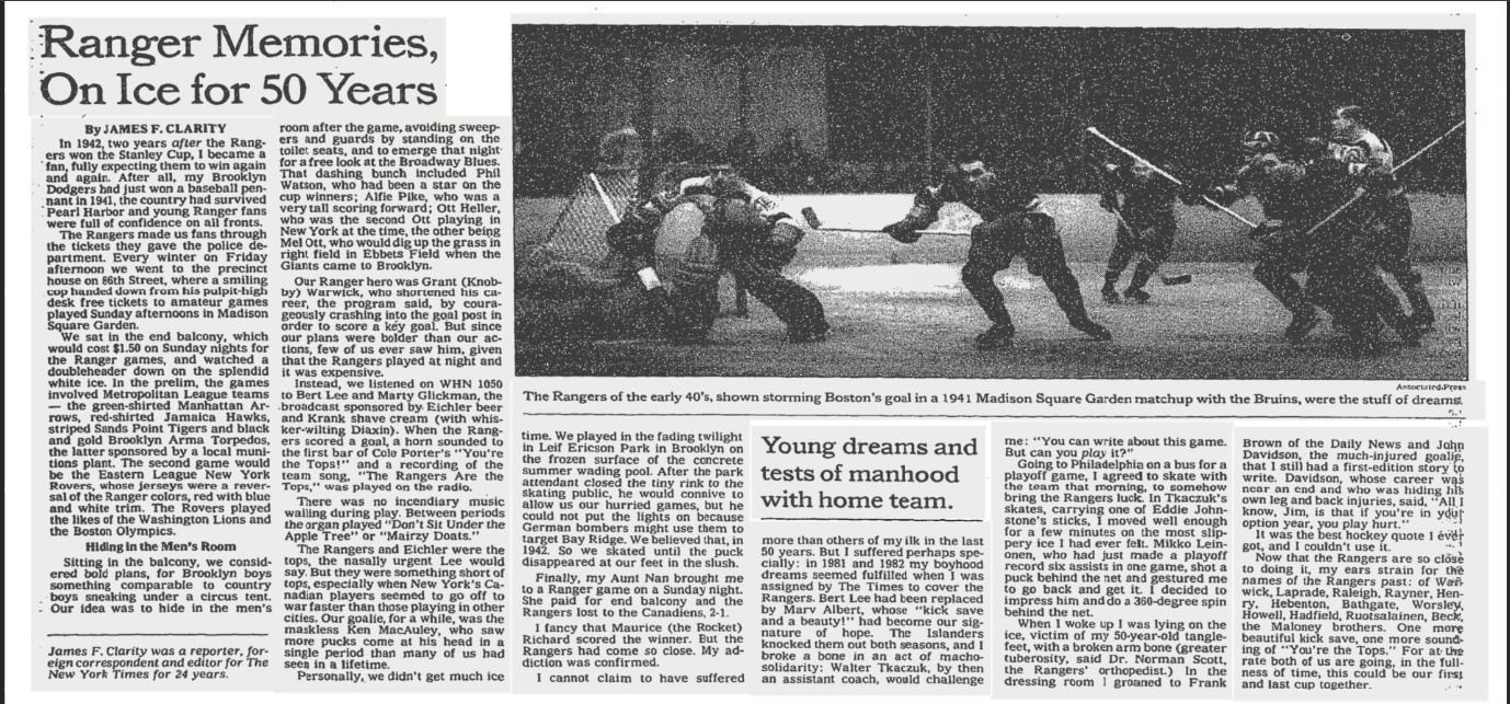
New York Times story by James F. Clarity, June 1994. He covered the New York Rangers in the early 1980s.
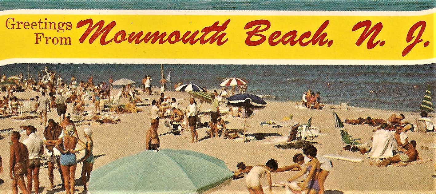
Greetings from Monmouth Beach, NJ sign, 1960s.
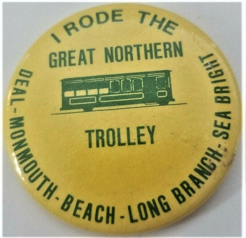
Great Northern Trolley Company button, 1986. The summertime streetcars operated out of Asbury Park.
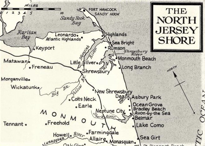
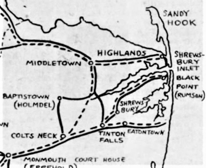
The Story of the Jersey Shore map, 1964.
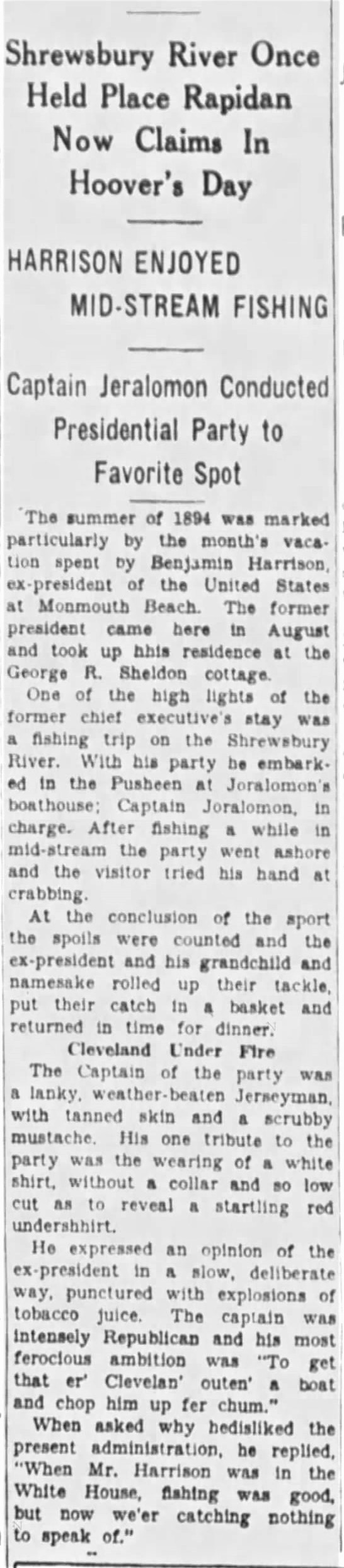
An amusing account of former President Harrison’s 1894 vacation in MB. Long Branch Daily Record, August 1930 “Gay Nineties Edition.”
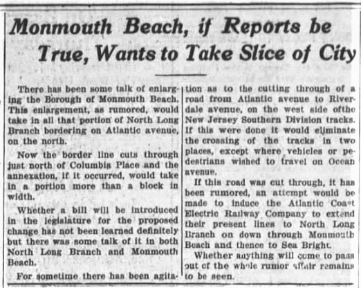
Monmouth Beach to “annex” North Long Branch. Long Branch Daily Record, Feb. 1917.
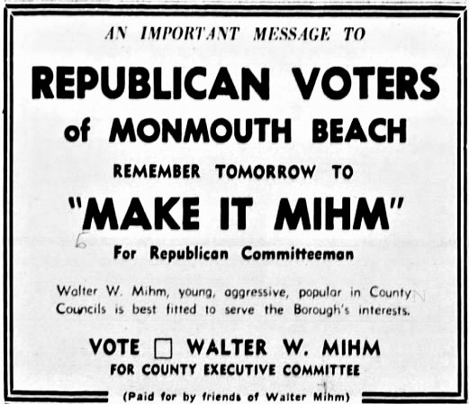
Walter Mihm political ad. Long Branch Daily Record, April 1952.
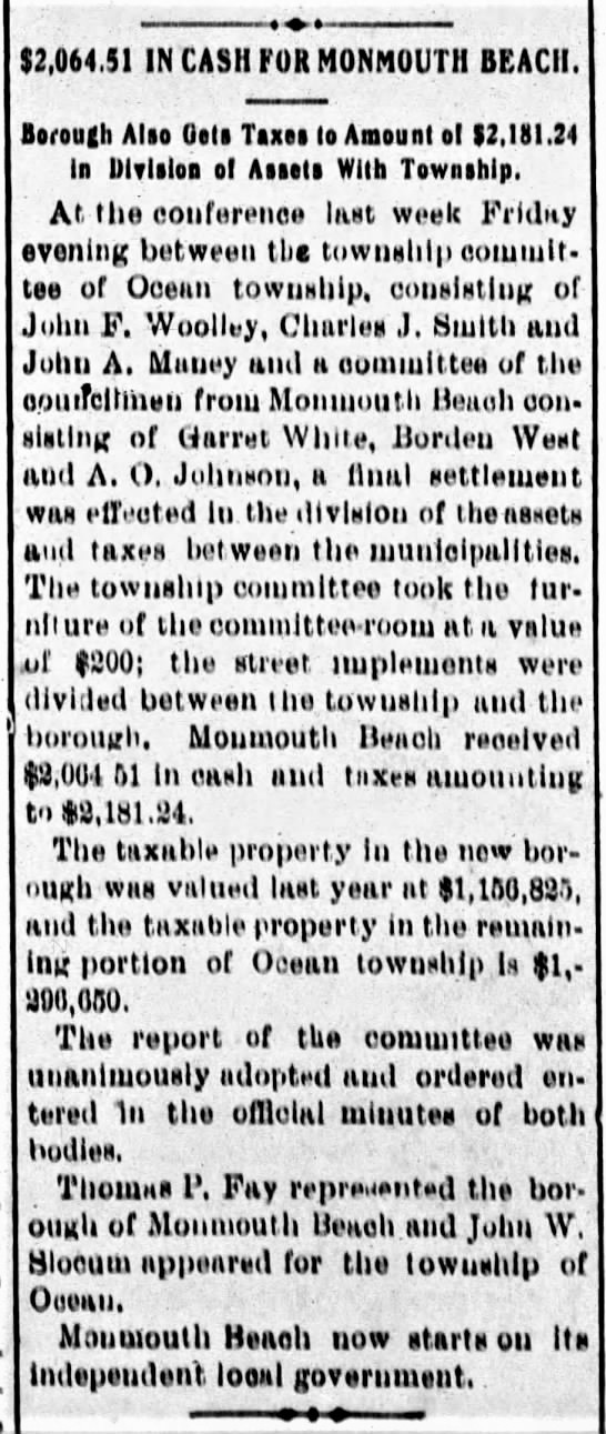
Monmouth Beach leaves Ocean Twp. with $2,064.51. Long Branch Daily Record, May 1906.
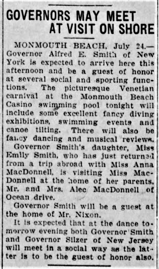
Governor’s Gala in MB, July 1925.
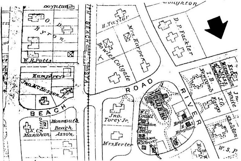
MB Clubhouse Hotel area, Wolverton Atlas, 1889.
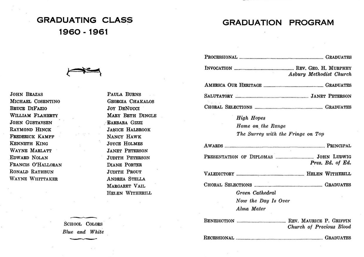
MB School program, Class of 1961.
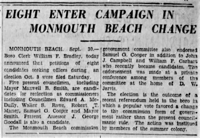
APP story about the first commissioner’s race in MB, Sept. 1929.
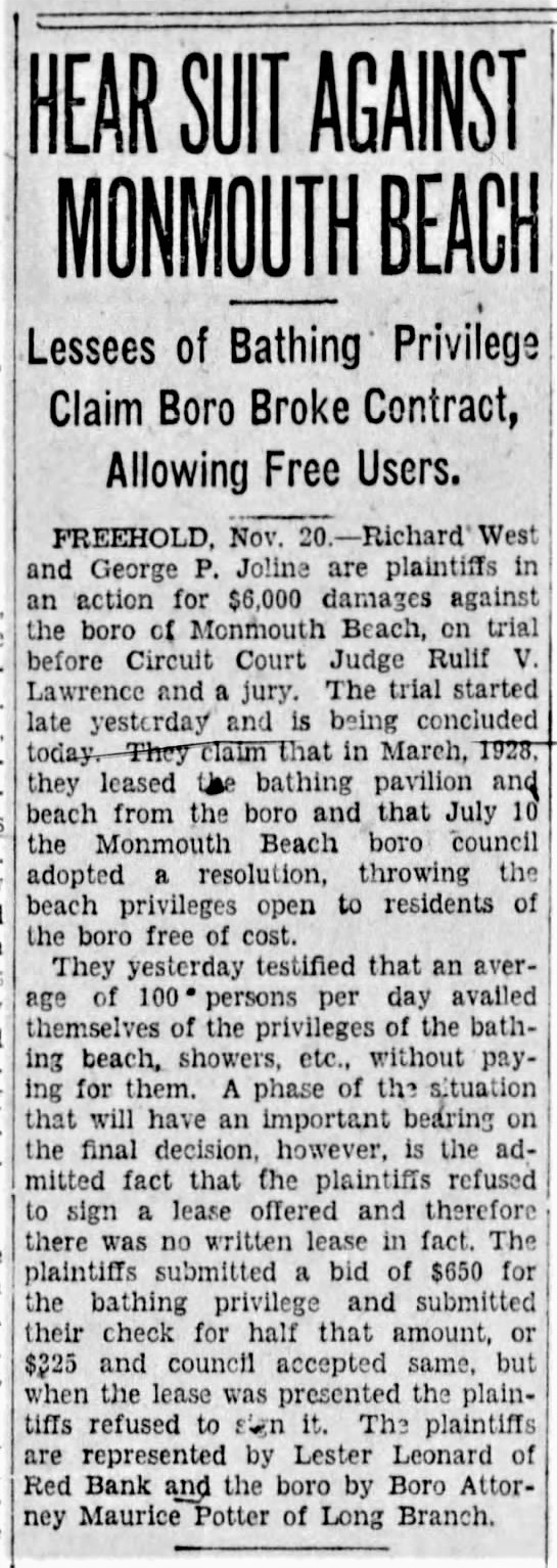
Free beach and lawsuit, APP November 1929.
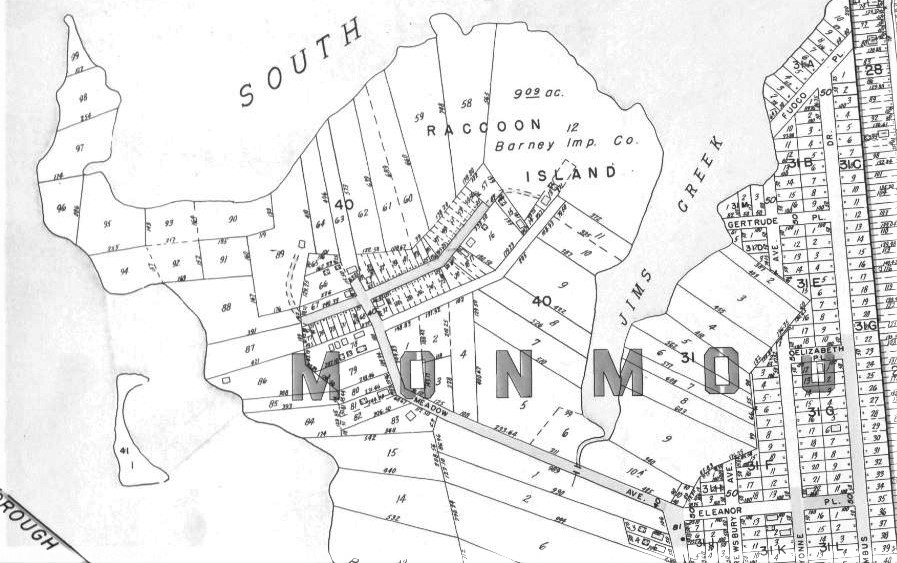
Racoon Island layout, 1941.
Monmouth Beach boarders, Plat Book of Monmouth County, 1941.

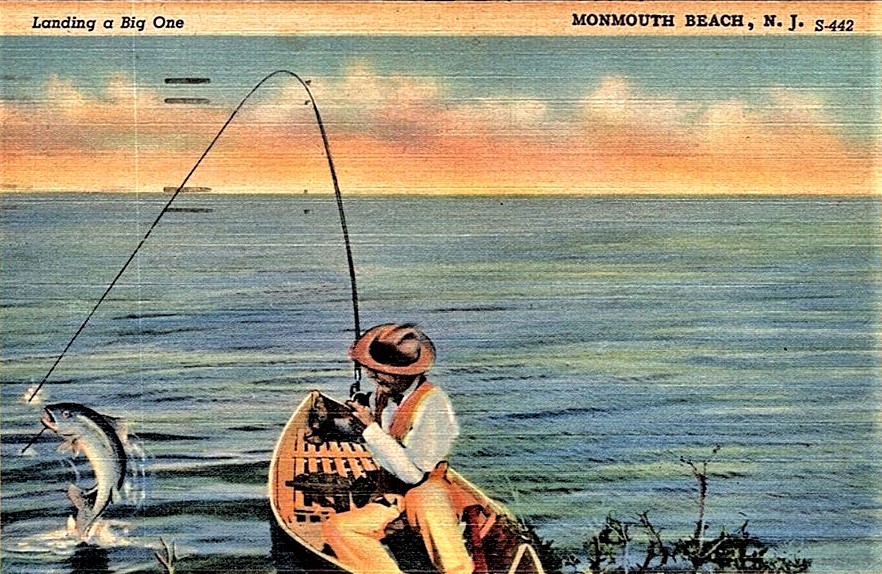
Jersey Shore Fishing Chart, 1970s.

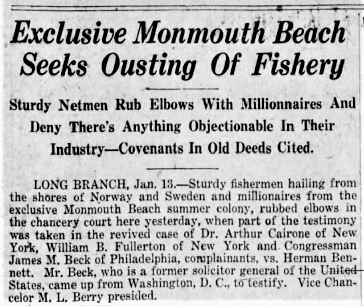
Monmouth Beach and the Mob, October 1935.
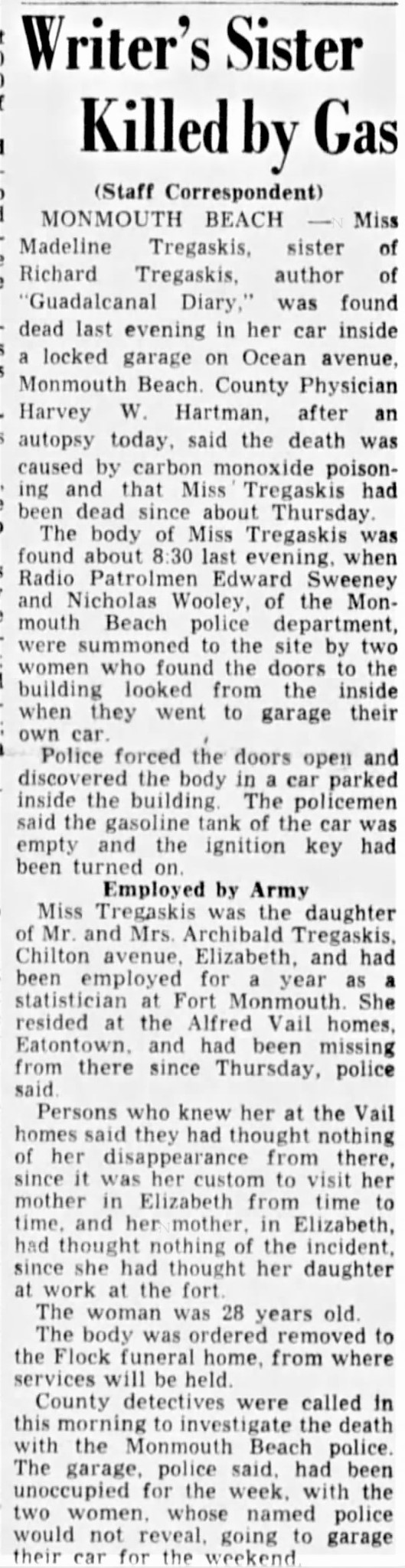
Obit for MB resident Madeline Tregaskis, sister of “Guadalcanal Diary” author, Richard Tregaskis, June 1943.
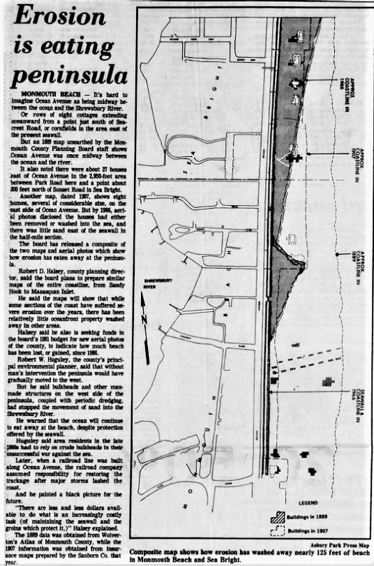
APP story on shore erosion in MB, January 1981.
Jersey Shore map, 1776.
Wouldn’t you have liked to have been at this sale? APP, May 1950.
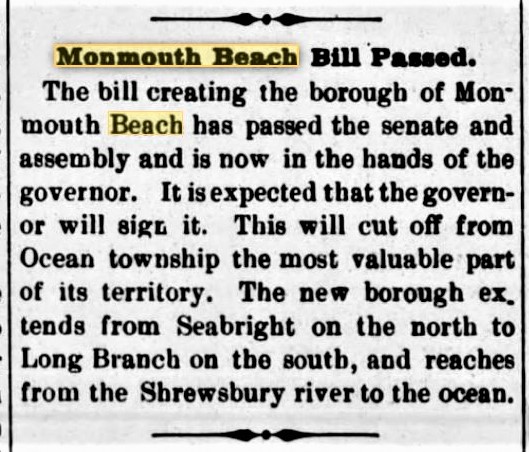
Asbury Park Press story on the beginnings of MB when it separated from Ocean Twp. May 1906.
End of days. Headline from APP, Jan. 1928.
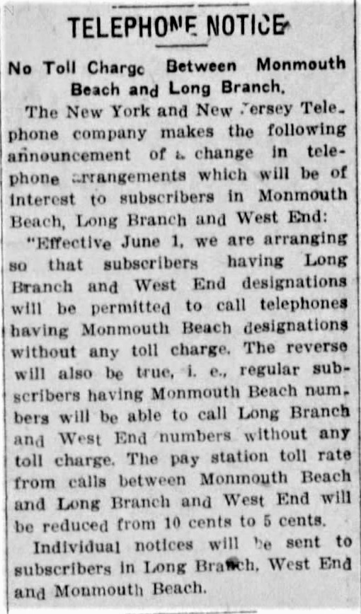
Making the call. APP, May 1909.
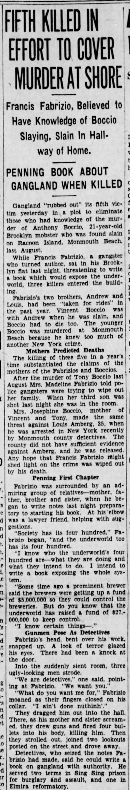
Murder & mayhem in Monmouth Beach. APP, November 1932.
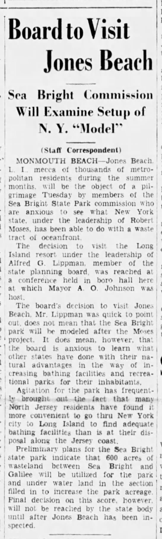
Plans for Sea Bright and Monmouth Beach to be part of a new state park, APP, August 1938. The proposed park was to run from ocean-to-river at 600 acres and cost $1.5 million. The plan also called for the construction of an ocean access inlet at “Low Moor.”
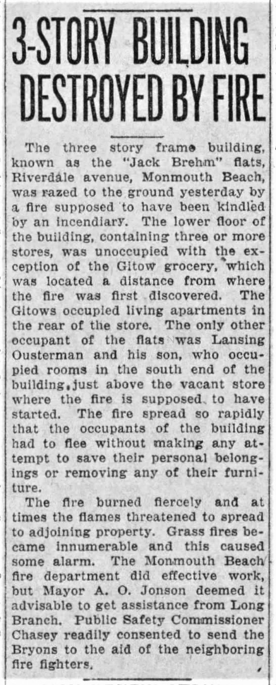
A grocery store owned by Robert Gitow on Riverdale Avenue? This APP story is from Feb. 1919.
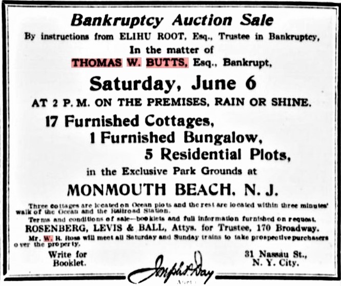
Monmouth Beach profiteer Thomas W. Butts losing all his borough possessions, 1910s.
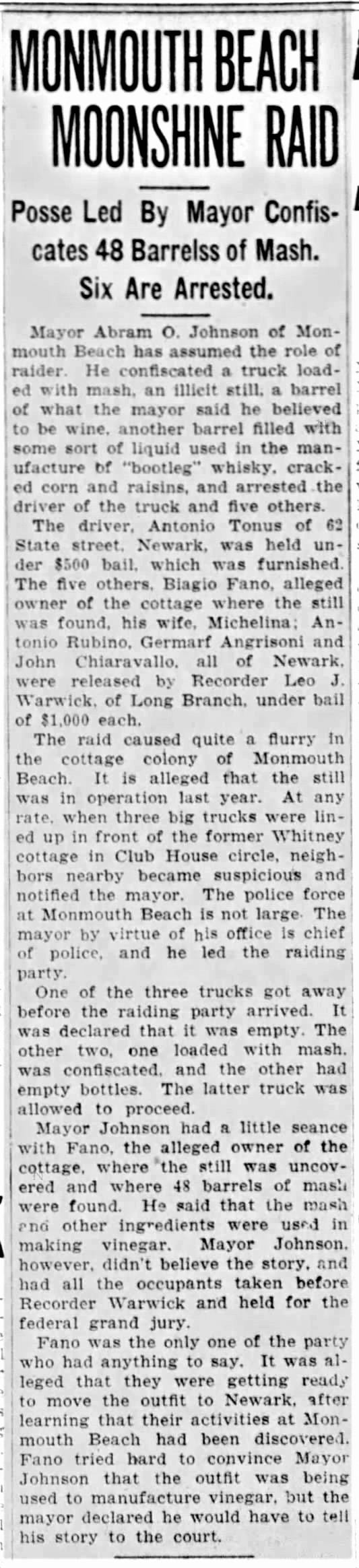
MB Moonshiners, June 1922.
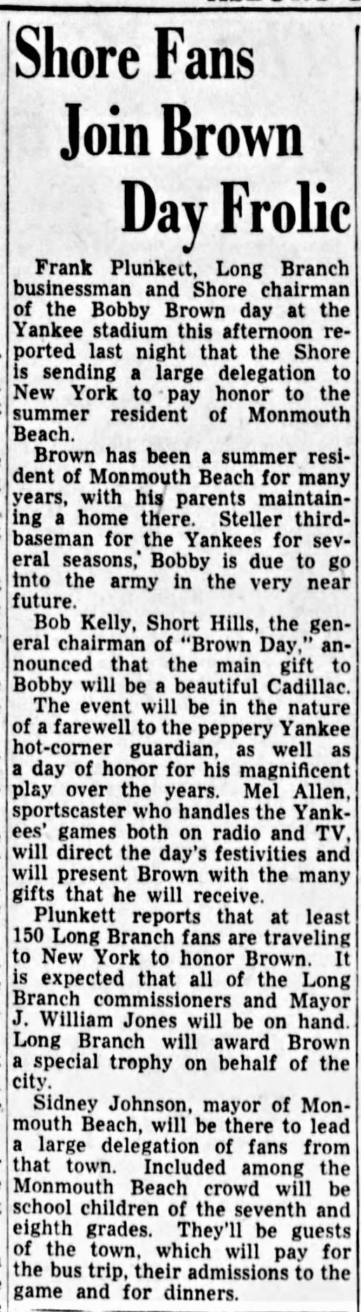
Bobby Brown was a MB resident, NY Yankee and physician. APP, 1951.
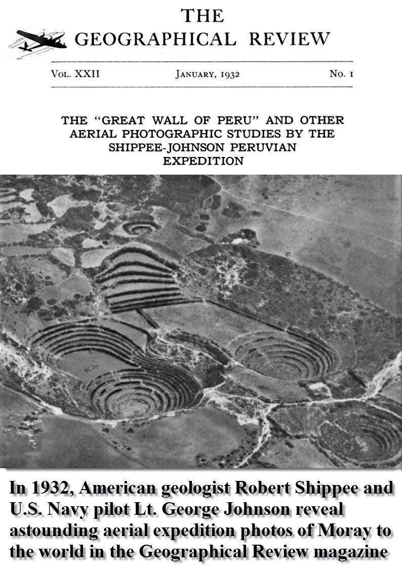
Robert Shippee, a Harvard-trained geologist, was a longtime MB resident. January 1932.
Asbury Park Press, April 1982.
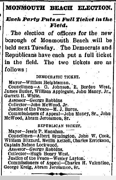
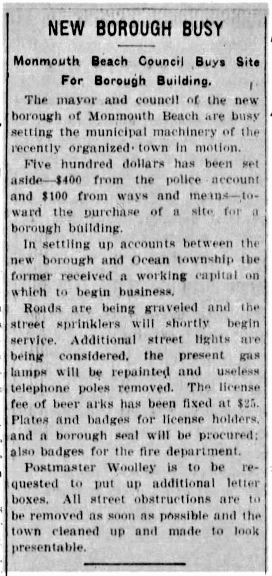
MB first borough election, 1906.
Those were the days … APP, July 1936.
MB town center, 1889.
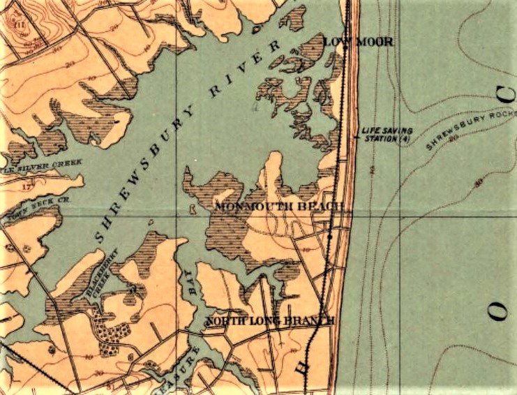
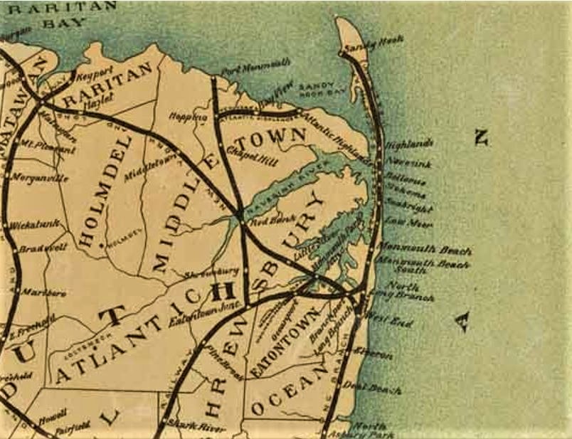
MB area map. Geological Survey of New Jersey, 1896.
Asbury Park Press, 1953.
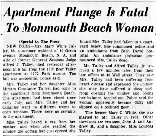
Sad Park Avenue plunge! APP, August 1940.
Asbury Park Press, July 1947. Any more info on this one?
MB area, Lightfoot map 1851.
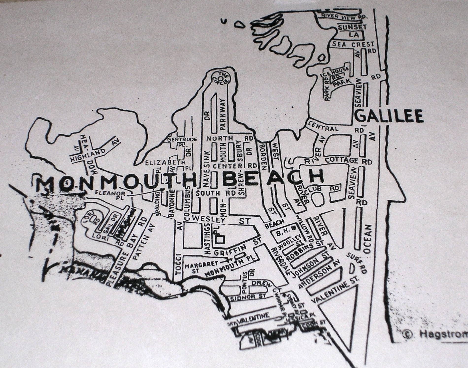
Monmouth Beach, Hagstrom map.
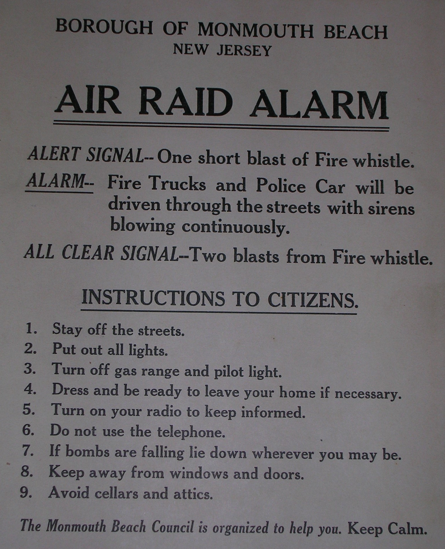
World War II air raid bulletin, 1940s.
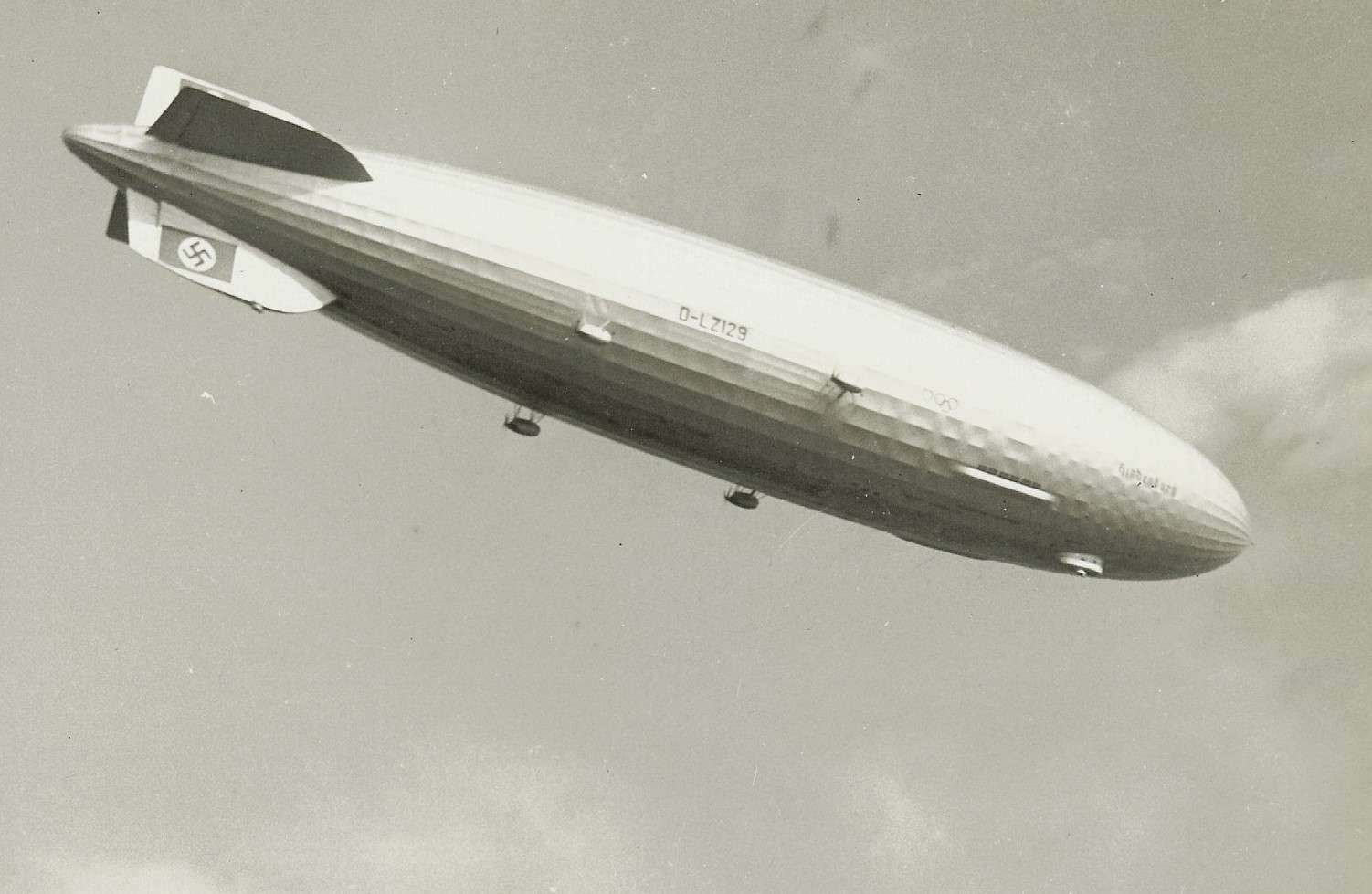
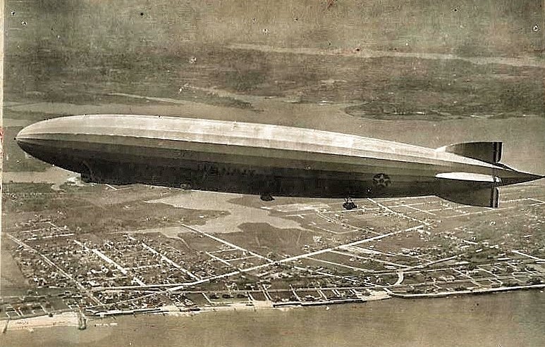
German blimp Hindenburg flying along Monmouth Beach coast, 1930s.

Shrewsbury Harbor Estates ad, 1974.
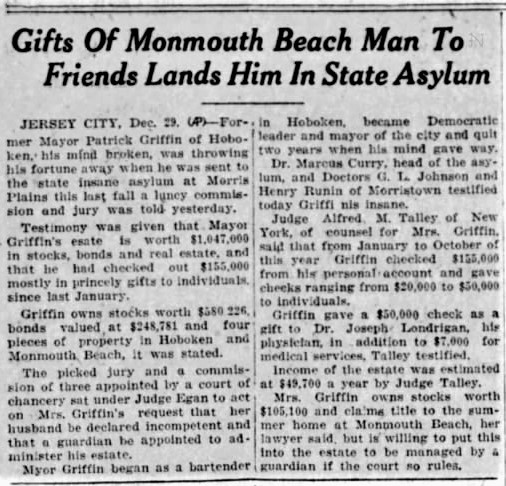
Odd story on Griffin Street/Park namesake. APP, December 1927.
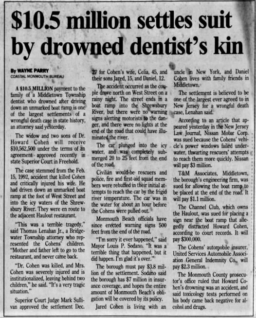
Story about the borough’s deadly auto-accident. APP, 1993.

Hamiltonian at Monmouth apartments ad, 1967.
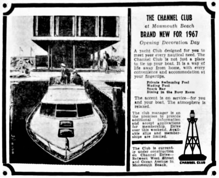
Channel Club ad, 1967.
Asbury Park Press, Summer 1902.
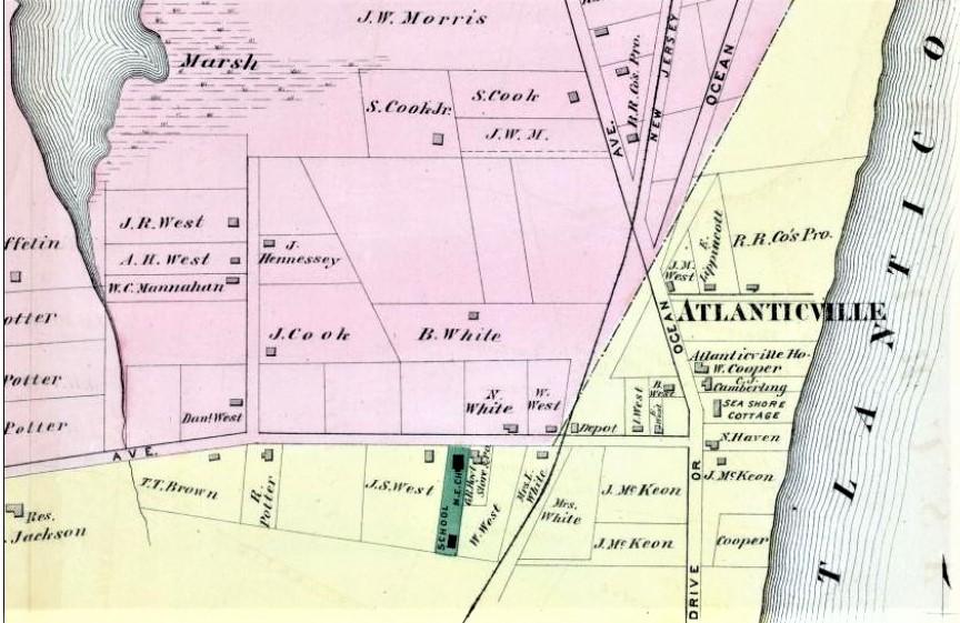
F.W. Beers Map shows that Atlanticville is in Long Branch, 1873.
MB Map. F.W. Beers, 1873.
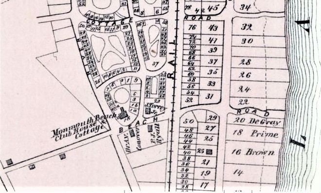
Map of MB Galilee section, late 1800s.
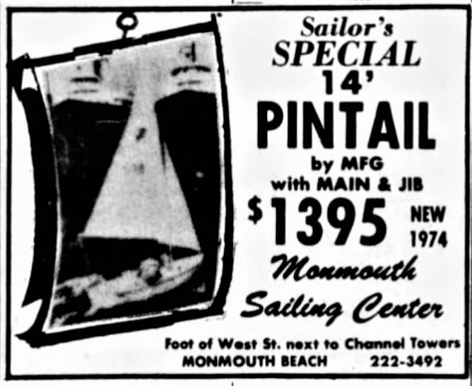
Monmouth Sailing Center ad. APP, May 1975.

Asbury Park Press ad, Sept. 1968.
Red Bank Register, August 1987.
Asbury Park Press, October 1983.

Borough native and special effects artist Lisa Clarity accepts a team Academy Award for “The Golden Compass” film, 2007. Lisa’s team captured another Oscar for their work on “Life of Pi” in 2012.
Blimp Los Angeles over MB, 1926 (Underwood Photo).
Survey map of MB, Woolman & Rose 1878.
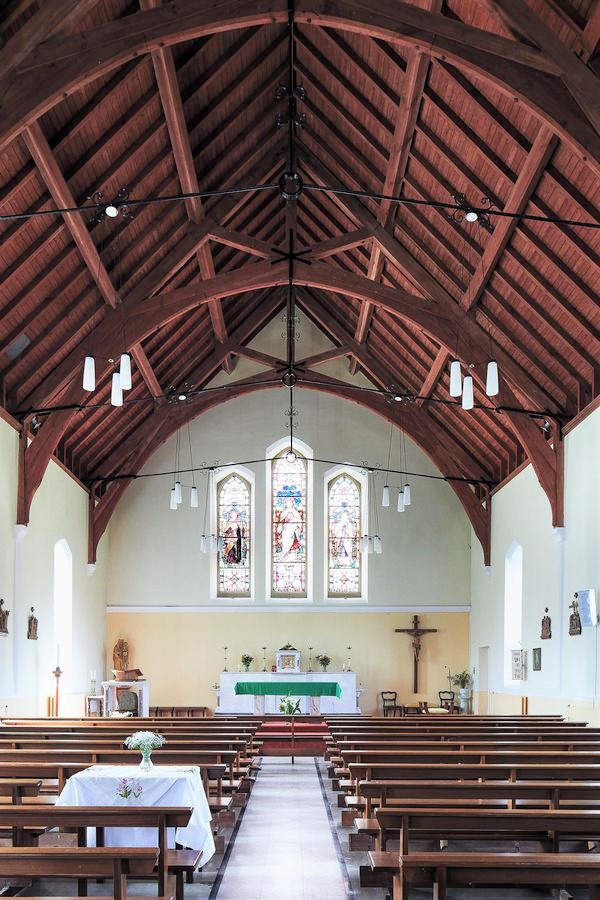
Look familiar? It’s the Sacred Heart Roman Catholic Church in Boho, County Fermanagh in Northern Ireland, 2020. Built in 1832.
MB postcard, 1940s.
Asbury Park Press headline, Sept. 1909.

Asbury Park Press, July 1939.
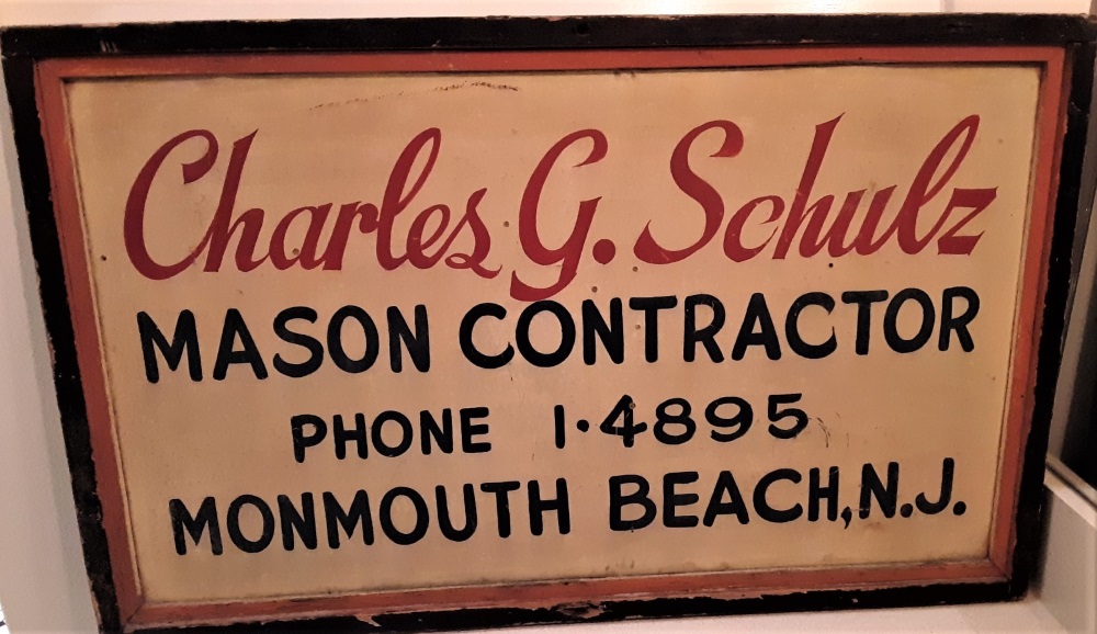
Schulz business sign in Beach Tavern, 2019.
Asbury Park Press ad, August 1921.

Map over MB area, 1770s.
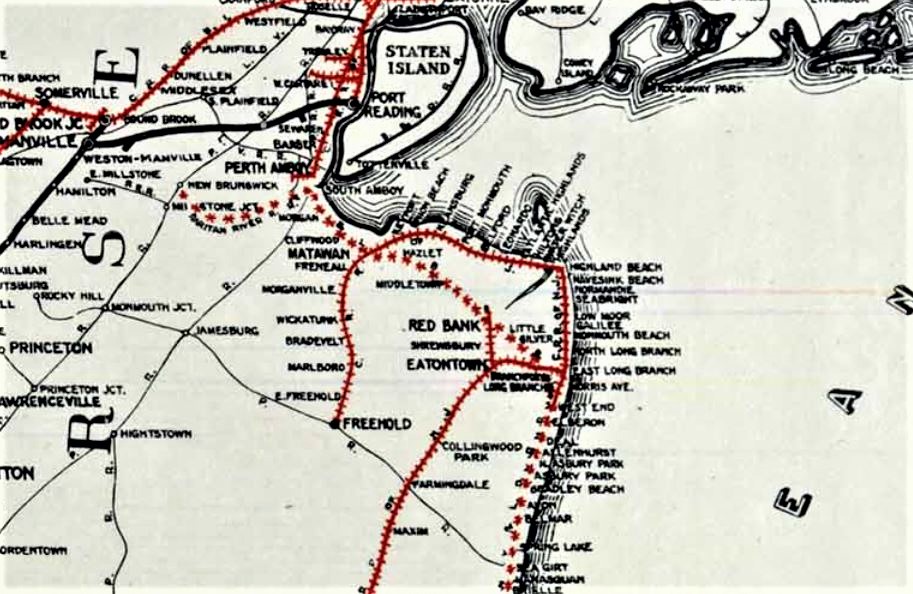
NJ railroad system around MB, 1887.
NJ Central Railroad system around MB, 1941.
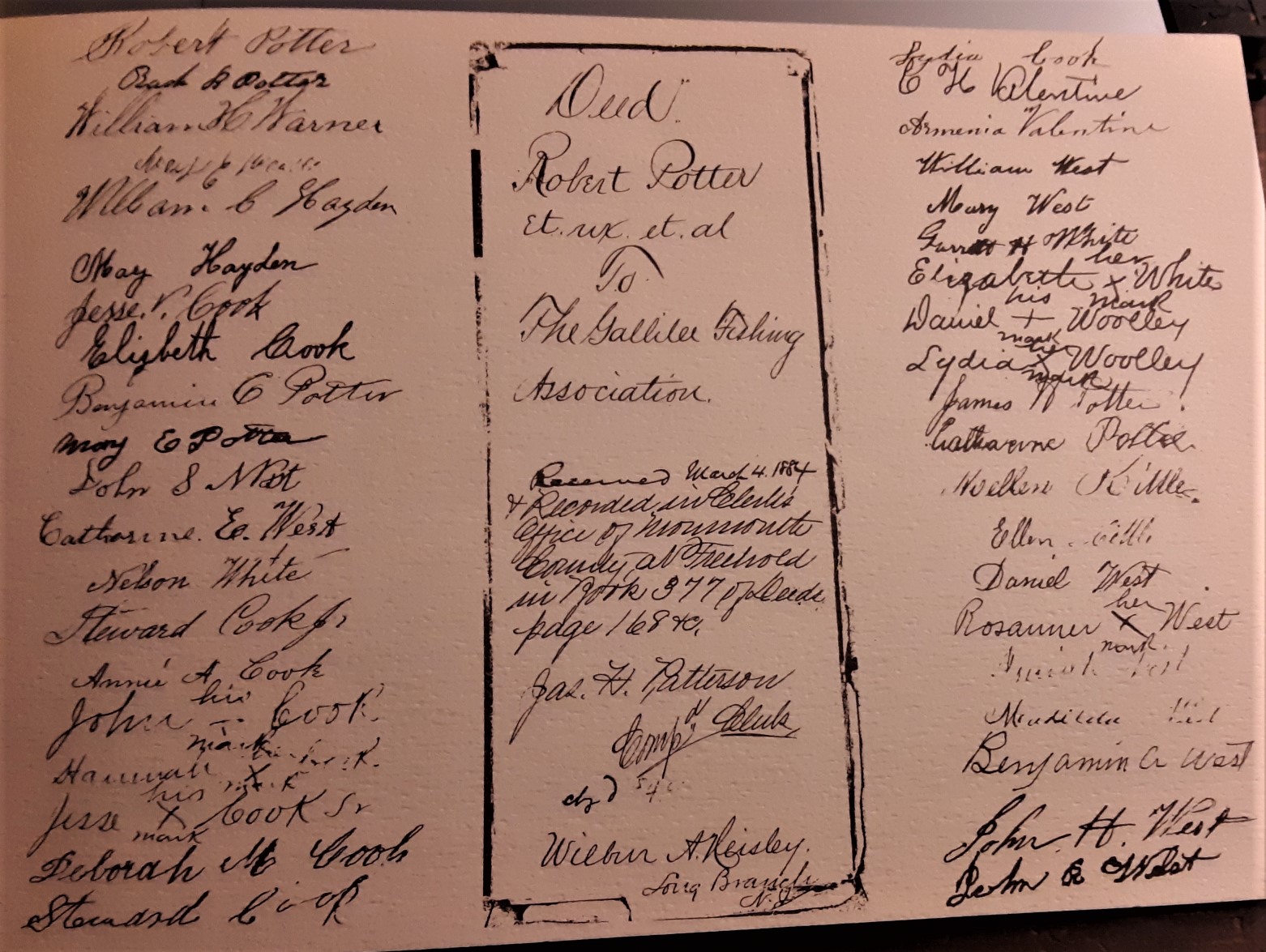
Galilee Fishing Association charter, signed March 1884.
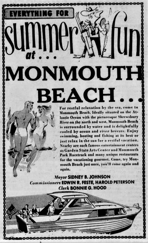
Monmouth Beach promo ad, 1960s.

Monmouth Beach islands? No it’s in Ocean Twp., 1973.
Asbury Park Press, 1994.

Asbury Park Press ad, 1979.
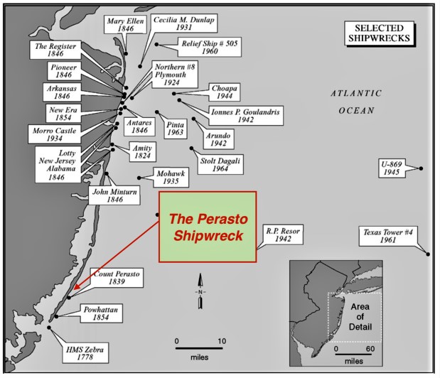
Map of old shipwrecks near MB.
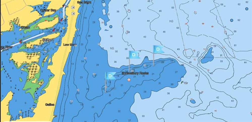
Map indicating “Shrewsbury Rocks” — a popular fishing spot off MB, 2015.

7-Eleven sought and failed to build a store at the corner of Beach Road and West Street, 1976
Map of MB Area, 1702.
Roads and Indian trails around MB, 1800.

Map of MB Area, 1770s.
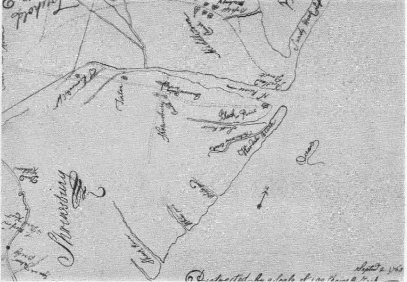
Lawrence map of MB area, 1765.

Daily Register story about MB bicentennial celebration, July 1976.
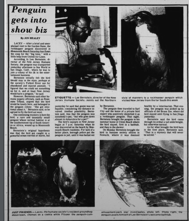
The MB penguin story, 1981.
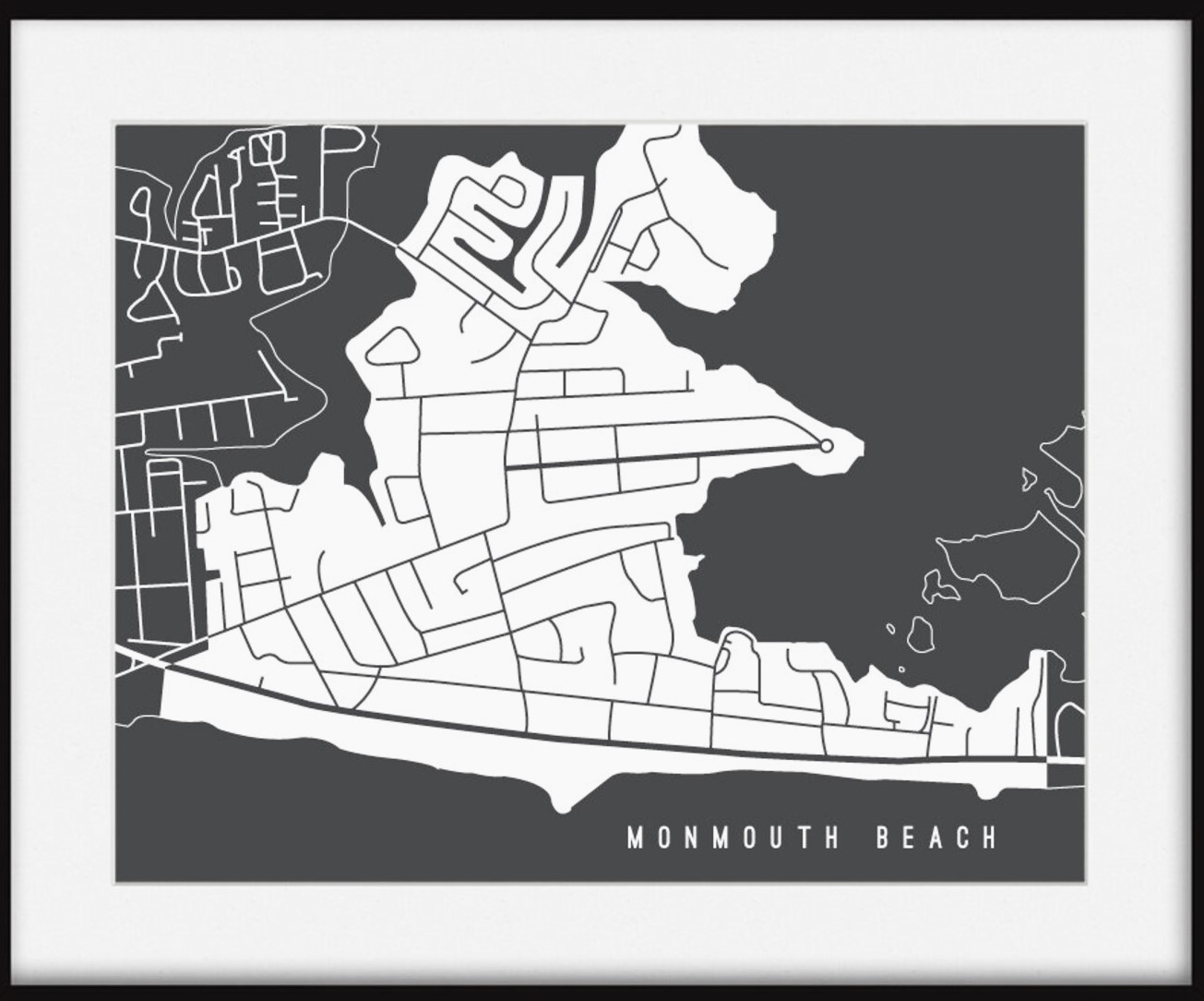
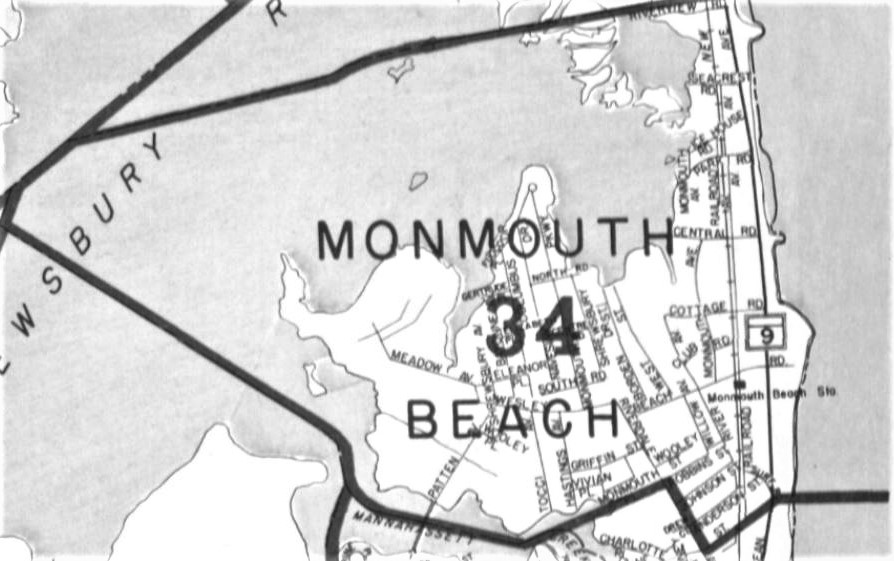
MB Map, 2012.
MB Map, 2012.

Image of Dr. Humphrey and his medical book, early 1900s.
MB sign with coordinates, 1920s.

Map of Monmouth Beach, late 1800s.
Monmouth Beach Journal ad, early 1970s.
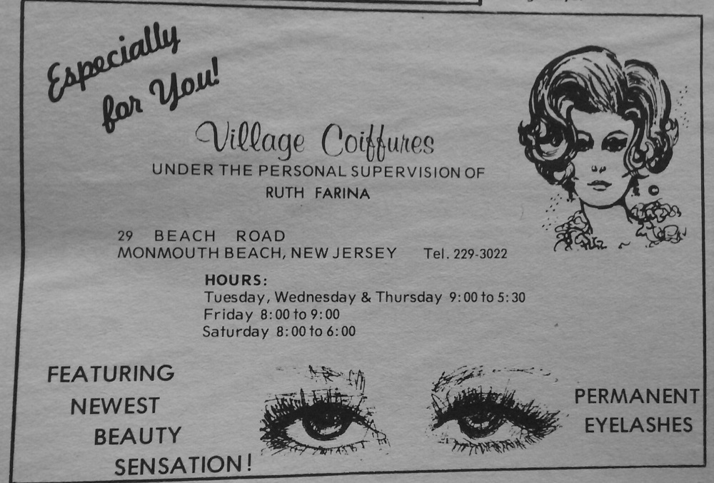
Monmouth Beach Journal ad, early 1970s.
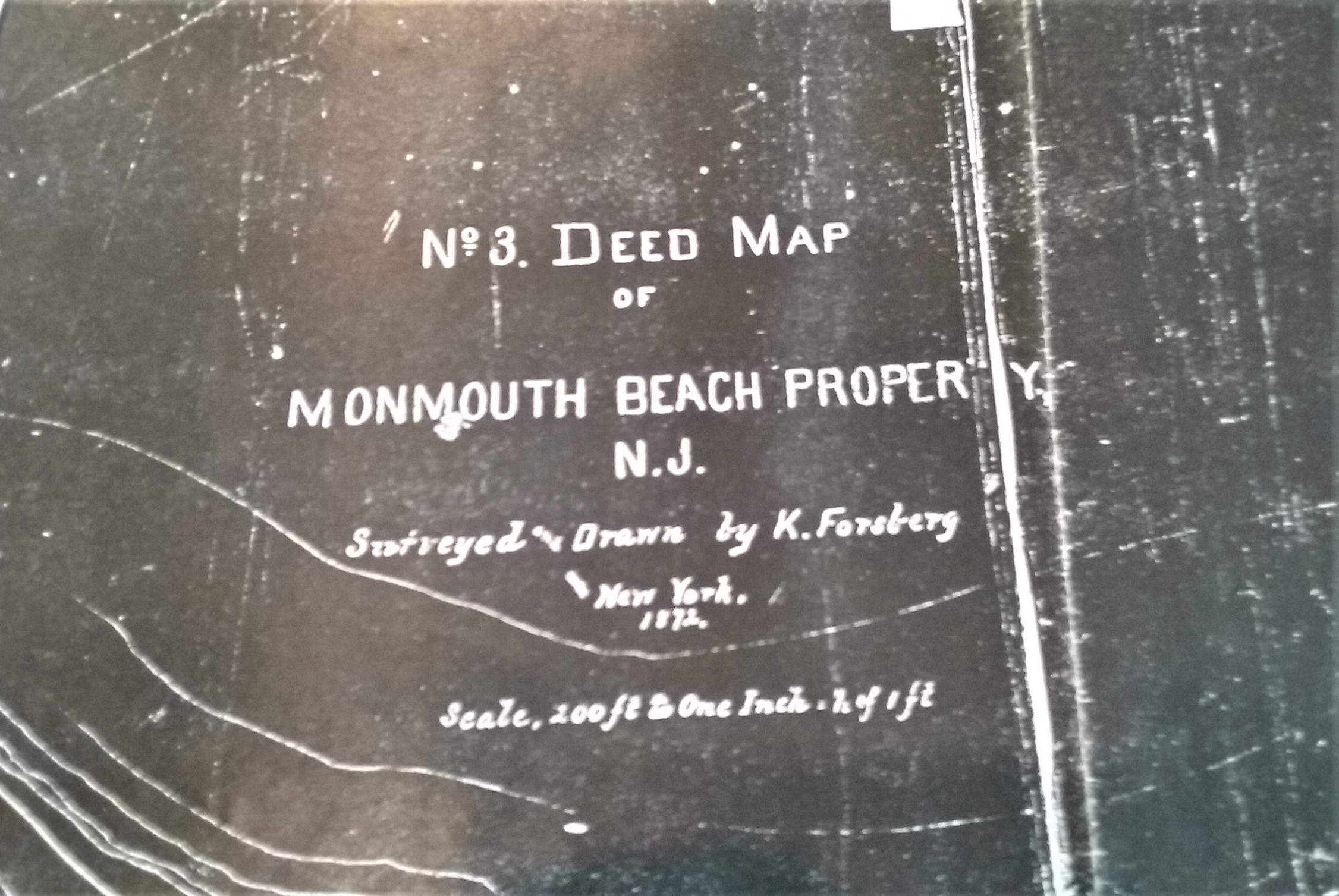
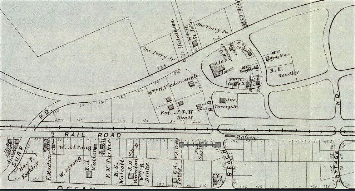
First official map of MB, survey by K. Forsberg, 1872.
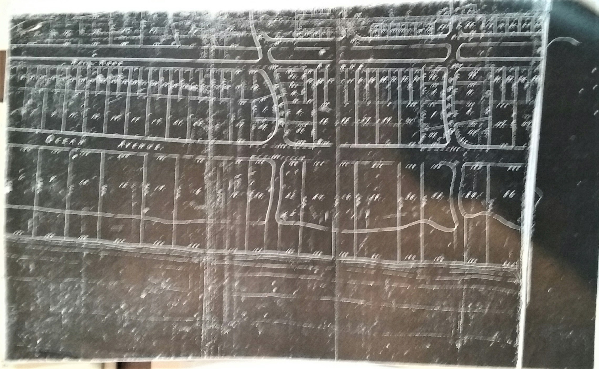
First official map of MB, survey by K. Forsberg, 1872.
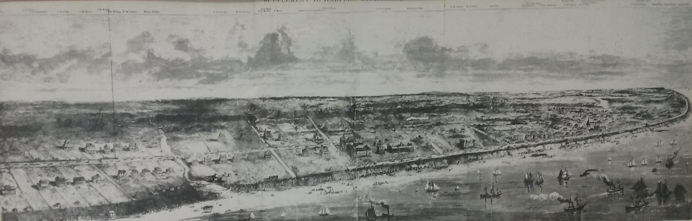
MB coast, late 1800s.
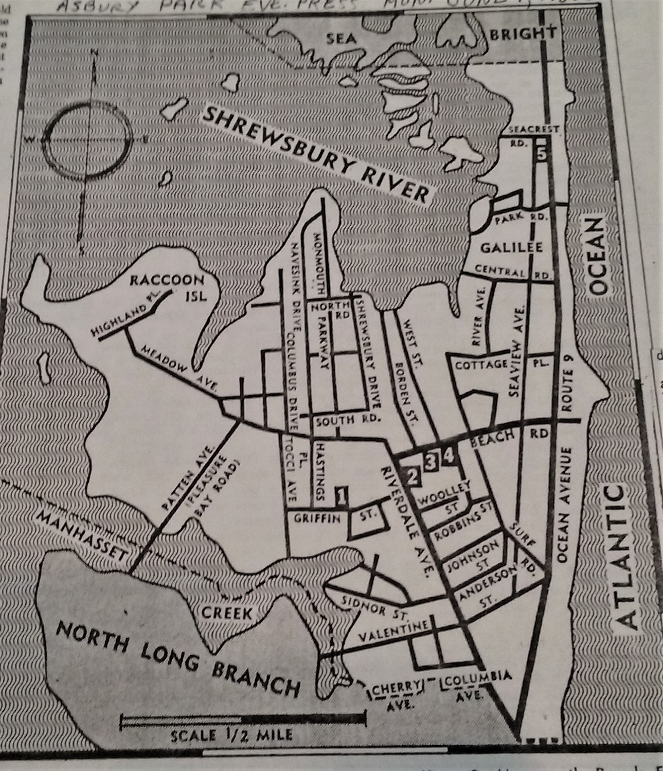
MB map, 1962
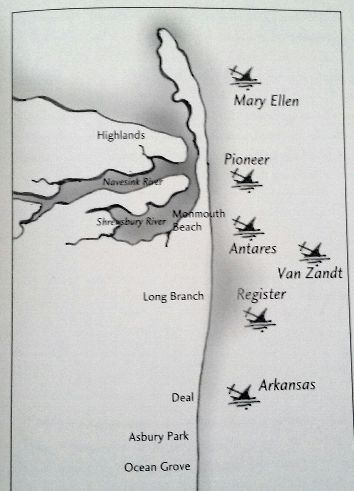
Map of shipwrecks off NJ coast, 1850s.
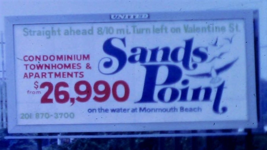
Sands Point condo billboard ad, 1970s.
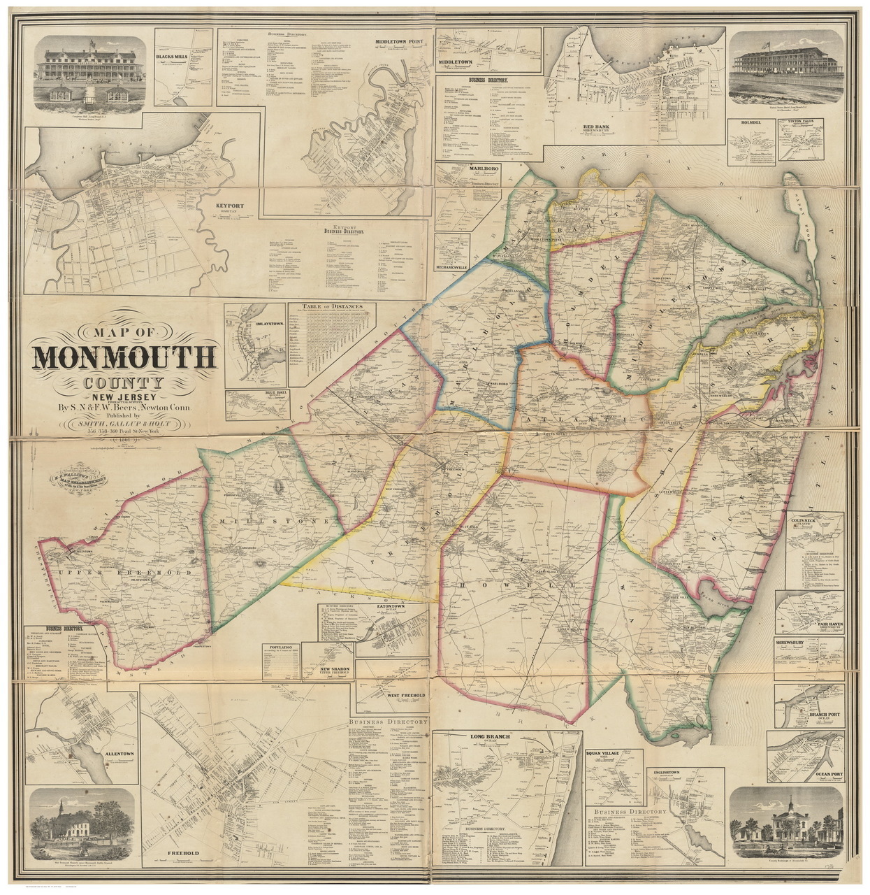
F.W. Beers Atlas of Monmouth County, 1851.
Monmouth Beach area map, 1812.

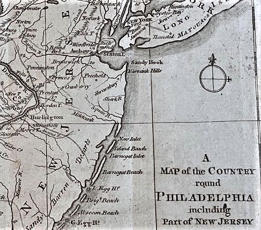
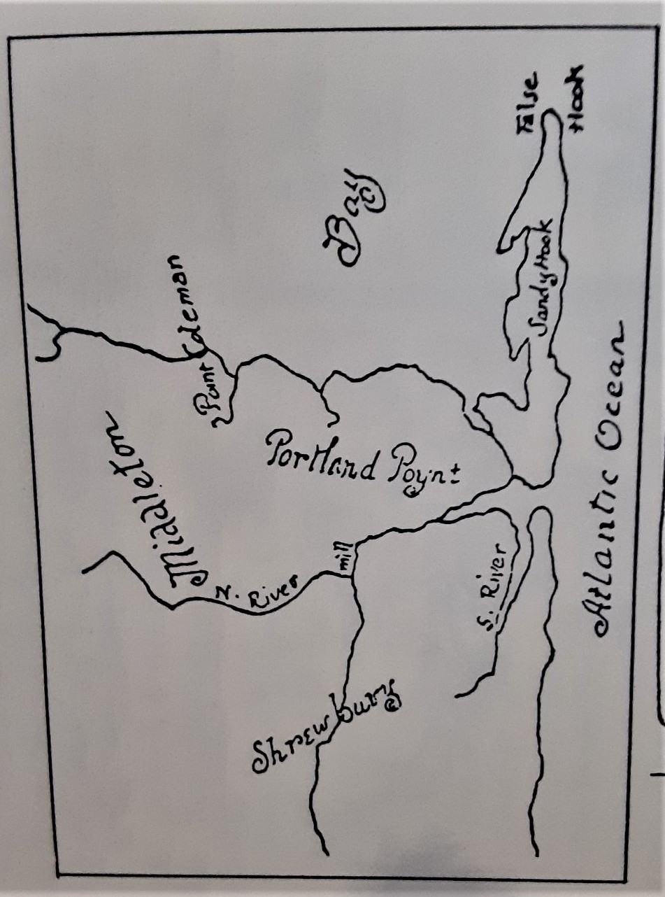
Monmouth Beach area map, 1769.

MB property map by Woolman & Rose, 1878.
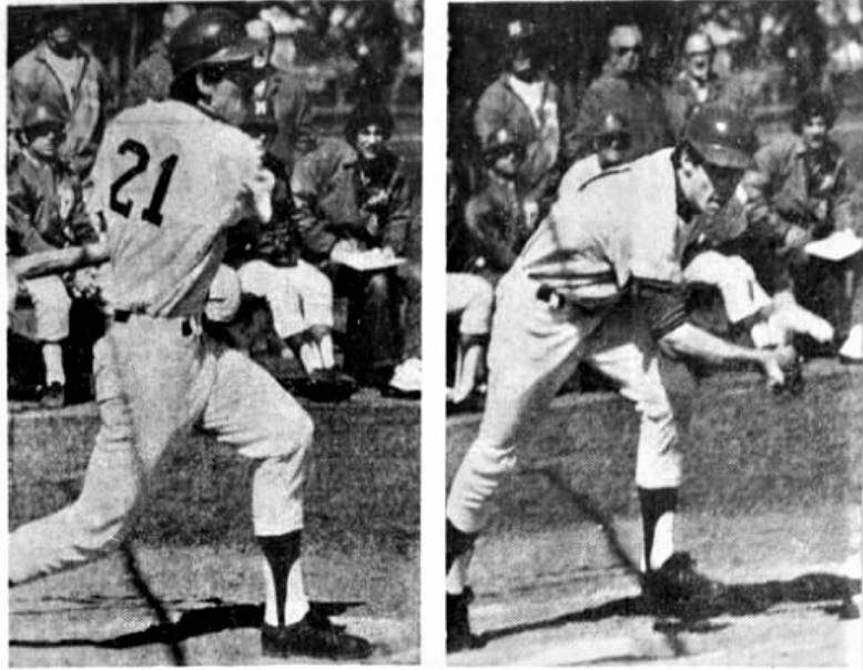
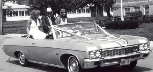
Jim McConville playing baseball for Monmouth College, 1972. Jim was the mayor of MB from 1997-2005.

MB building zone map, 1930.
Map of Monmouth Beach, NJ, 1889.
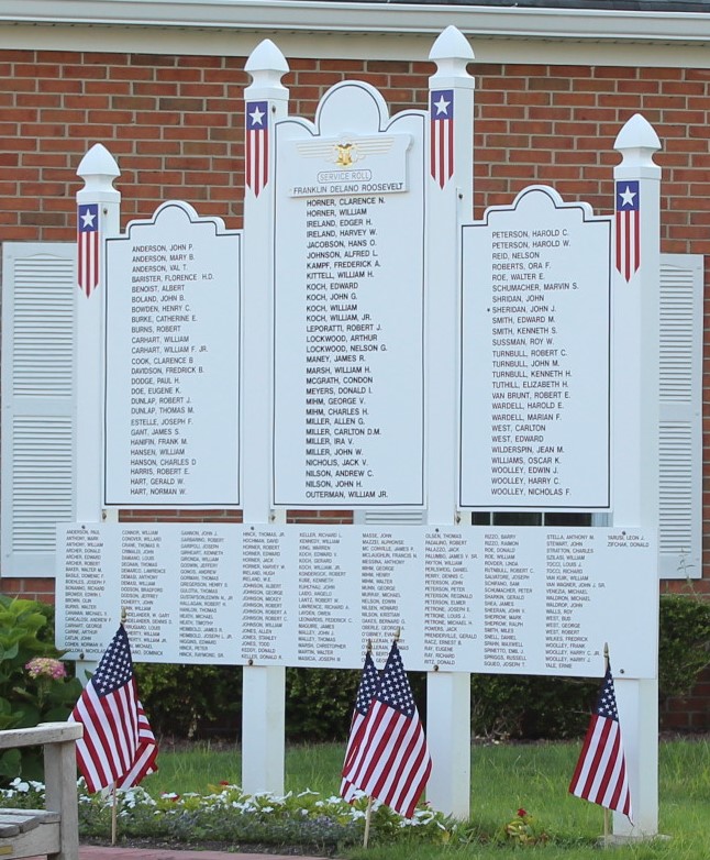
MB veterans memorial on Beach Road, 2017
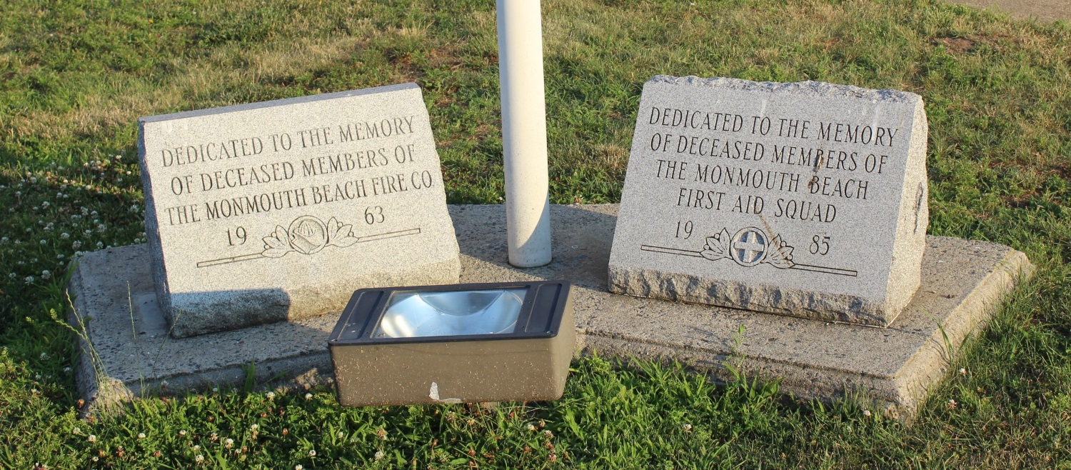
MB Fire Company-MB First Aid memorials on Beach Road, 2017

Map of the North Jersey Shore, 1702.
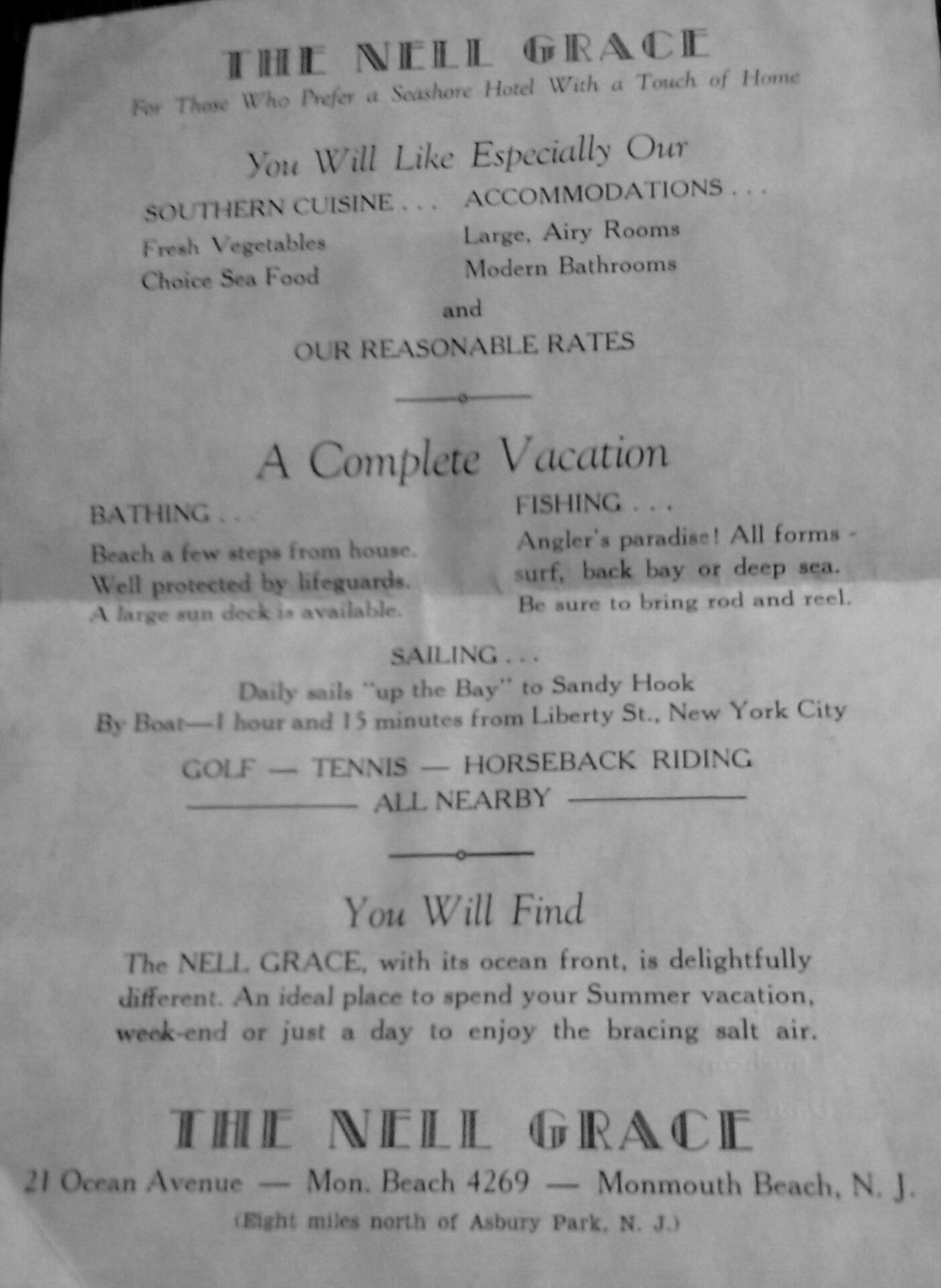
Ad for The Nell Grace hotel on Ocean Avenue in Monmouth Beach. Built as a private home in 1891 by A.P, Poral, the hotel burned in March 1941.
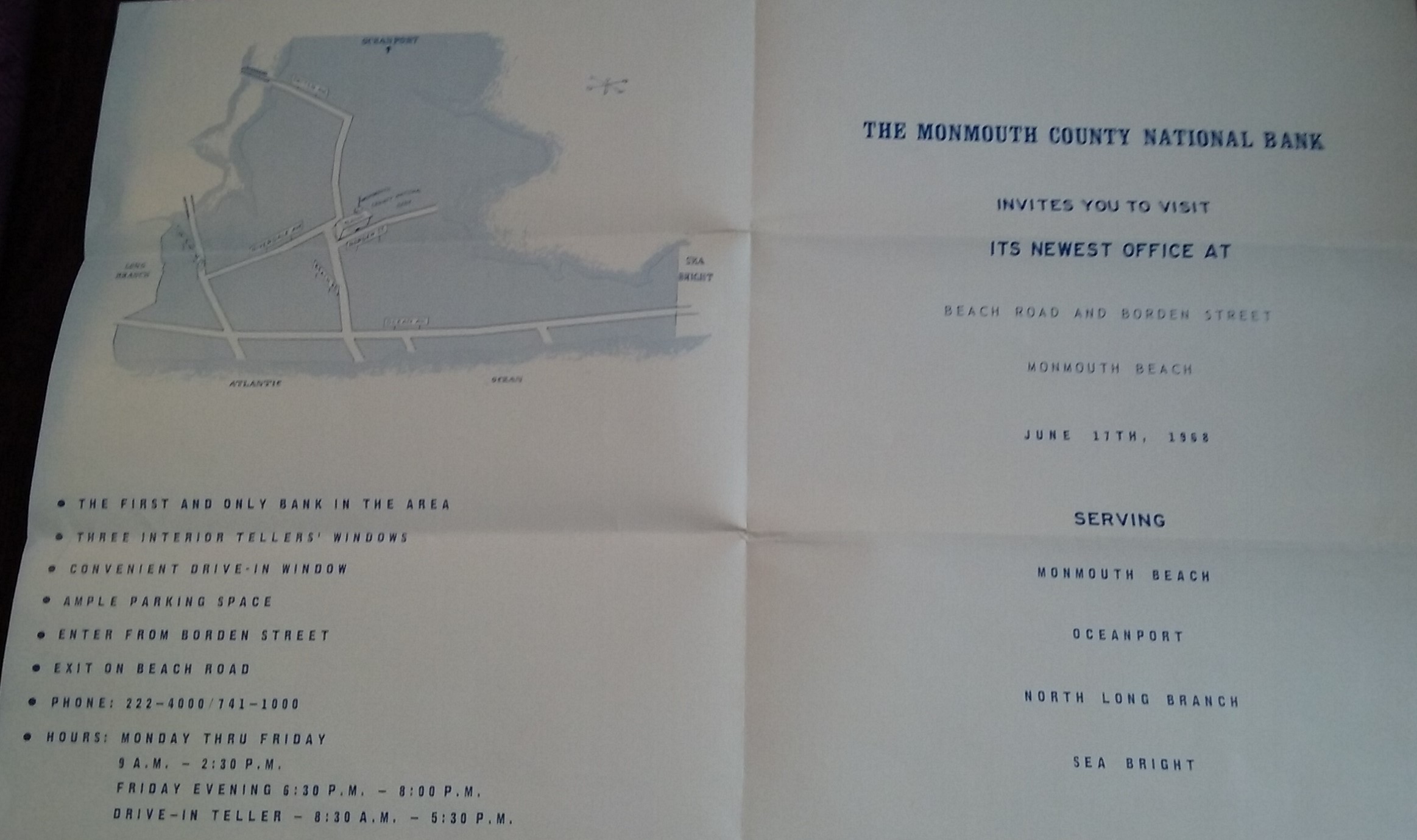
New Monmouth Beach bank ad, 1968.
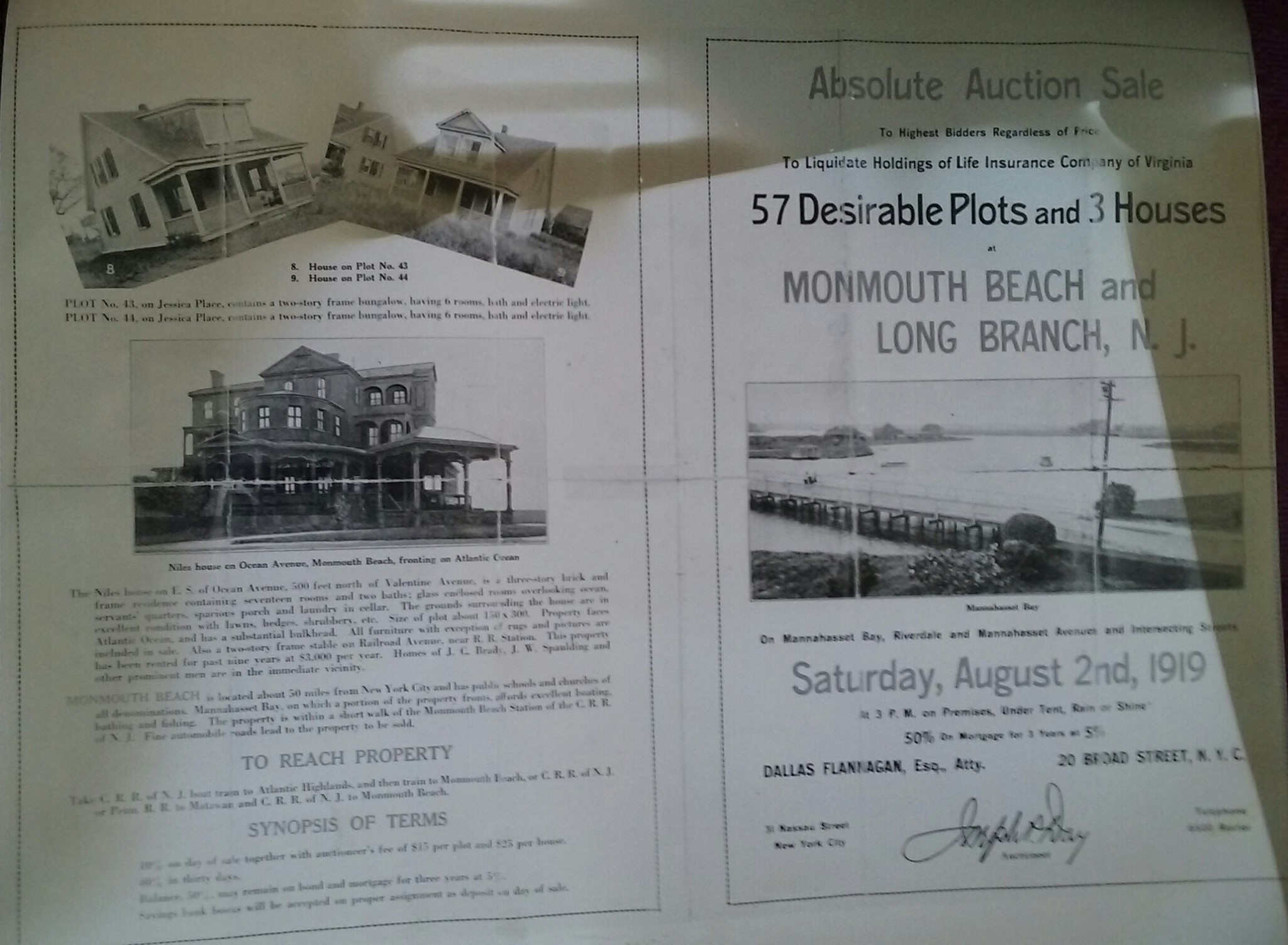
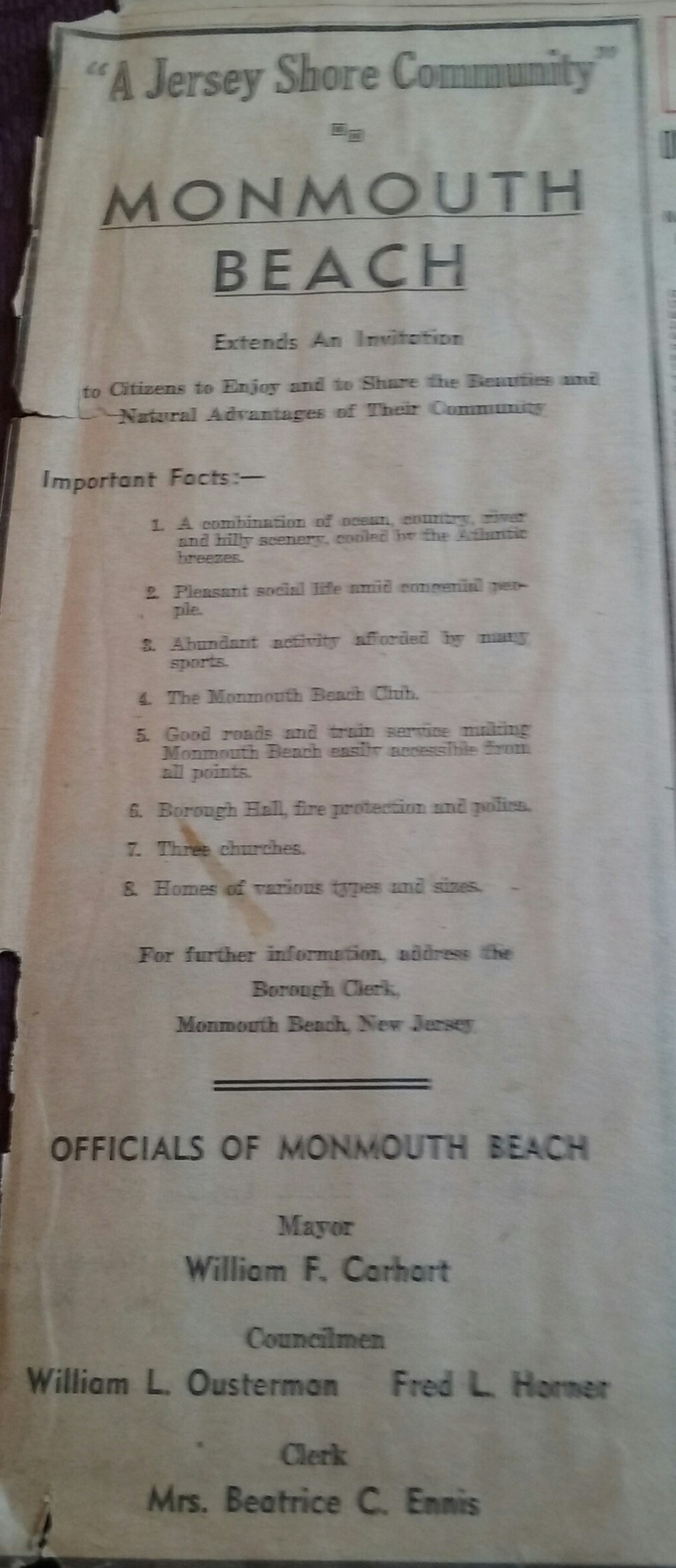
Flyer for Monmouth Beach property auction (front), 1919.
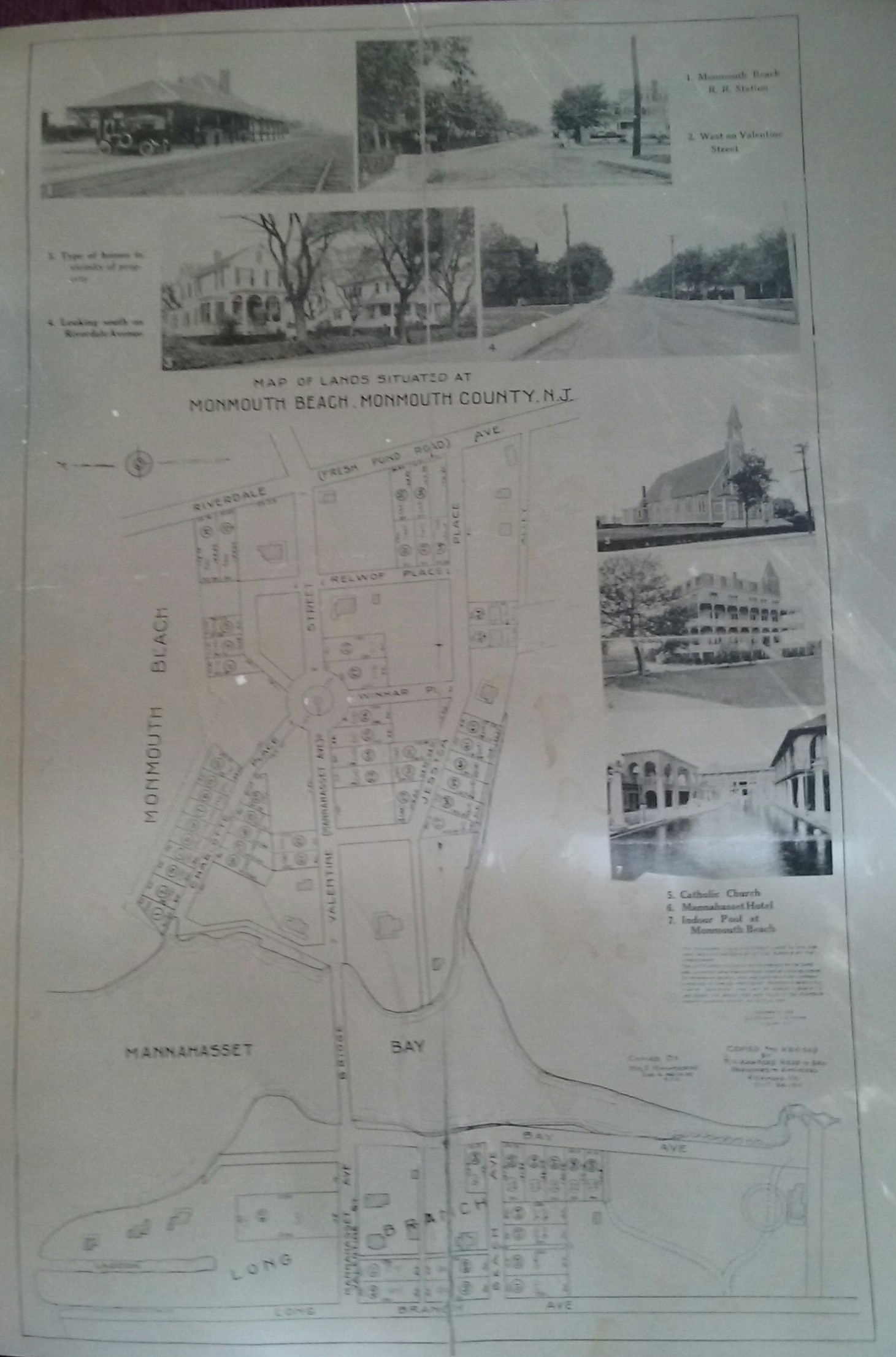
Flyer for Monmouth Beach property auction (back), 1919.
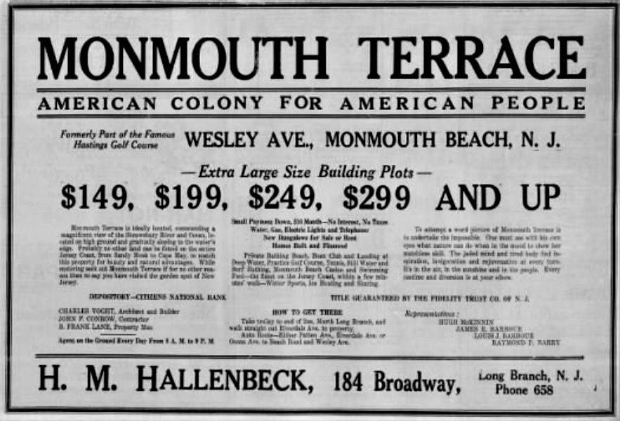
Monmouth Beach land advertisement, 1930s.
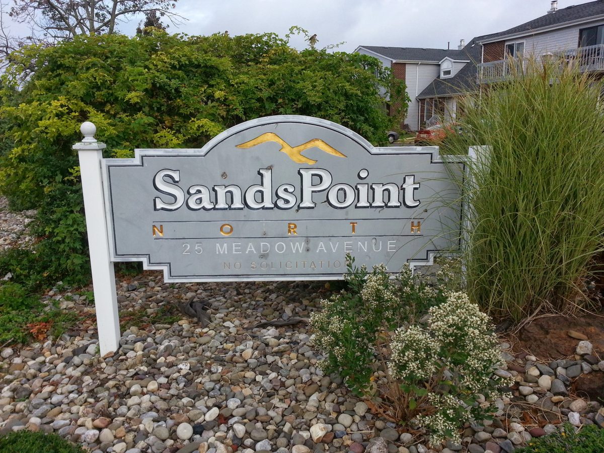
Sands Point North condo complex in Monmouth Beach, 2010s.