’25 Hurricane Season: Be Ready
Experts Predict “Extremely Active” Storm Season …
Living at the shore comes at a price. Wise lifelong coastal residents know this. It’s understood that natural forces of wind and water have been shaping our shoreline for millions of years. That’s life at the beach.
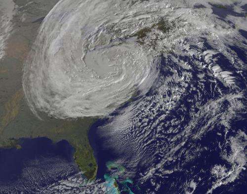
Satellite image of Sandy over the Northeast.
With the 2025 hurricane approaching — officially from June 1 to November 30 — shore residents must be especially on guard. Rising sea levels, growing federal and state government insolvency, and coastal over-development means we beach folks already face serious challenges to our permanence.
And this season might be a rough one. The National Oceanic Atmospheric Administration Climate Prediction Center has forecast 23 named storms, 11 hurricanes, and 5 major hurricanes — meaning there’s a 62% chance that a bad one hits the US coast. A major hurricane is Category 3 or stronger on the Saffir-Simpson Hurricane Wind Scale. Cat 3 winds can reach 130 mph with storm water surges up to 12 feet above the mean high tide.
This is the price we beach bums must pay. And we got hammered not long ago — by “Superstorm Sandy” in late-October 2012. Our area had a taste of “the big one” only about a decade ago now.
“Nature to be commanded must be obeyed.”
—Francis Bacon
Beyond the wrath of Sandy, history finds only one intense hurricane made landfall in New Jersey in the past 350 years in 1821 (others recall bad ones in 1938 and 1910). Although the chances generally favor us — most hurricanes lose their energy before reaching the Jersey Shore — any appreciation for the law of averages means understanding that the longest odds will sometimes hit.
Massive tides surges, brutal winds, a peak summer population, limited and clogged escape routes, and complacency (too many coastal dwellers underestimate hurricanes) could combine to intensify an already unthinkable weather disaster.
The borough — basically a low-lying barrier beach bracketed by the Shrewsbury River and Atlantic Ocean — is particularly vulnerable. Geologically known as the Northern Headlands, our immediate shore area is “characterized by narrow beaches at the base of deteriorated bluffs and dunes that have been eroded by years of storm damage,” according to the pros at Hurricaneville, “offering the least suitable natural and artificial protection from erosive forces.”
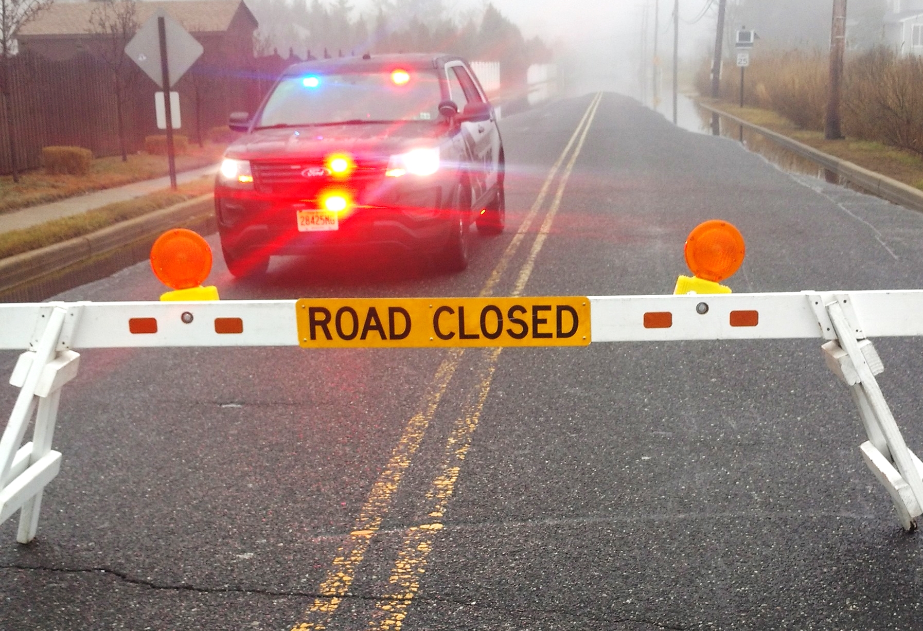
Not this way — Flooding on Patten Avenue, 2020.
Have a Plan!
Shore residents can not count on government of any stripe to “save them” from a major storm. True security comes only in having an escape plan and the discipline to employ it when the time arrives. If we’ve learned anything, it’s that weather is unpredictable.
Even the most advanced climate-tracking technology is no match for Mother Nature’s wrath. Late changes in a storm’s path could leave thousands unprepared. Bottom line: all shore dwellers must be vigilant and always have a “Plan.” Here are some other basics to consider:
• Shore residents should always be a little more alert and prepared during the hurricane season.
• If you suspect serious weather trouble, listen to the Weather Channel. Tune into the borough’s radio station at 1640 AM for regular weather updates. The MB Office of Emergency Management also has a Facebook page.
• Have a personal escape route planned and a safe location predetermined. The borough has posted Coastal Evacuation Route signs throughout town. Know them and have your gas tank full.
• Assemble and maintain an emergency & survival kit. This should include a flashlight, radio, batteries, first aid kit, nonperishable foods, three gallons of water per person, and protective clothing.
• For more information visit the National Hurricane Center.
And …


Have you done an article about Sandy specifically? I would be very interested in seeing pictures taken during and just after the storm.
My family evacuated, and we were displaced for 2 years, 3 weeks, and 5 days before we could move back into our home. I have always wondered if there are pictures out there taken by people who did not evacuate and rode out the storm.
I lived the aftermath, but am interested to see pictures taken during the storm.
Thank you.
Every time I read one of your posts, I come away with something new and interesting to think about. Thanks for consistently putting out such great content!