It’s been over a decade since the Monmouth Beach, Long Branch and Sea Bright area felt the awful wrath of Mother Nature. It was a huge fall storm that shook our three Jersey Shore towns — MB • LB • SB — to their very foundation.
Some people still haven’t recovered. I’ll even wager a fair amount don’t like being reminded. But 10 years have past since this extremely destructive force of nature slammed into the nation’s Northeast Coast. And if you live by the beach — storms must always be a worry. Hence, be prepared. We’ve had a taste of “the big one” within recent memory. It made a meal out of the Jersey Shore — our home! Be ready — HERE.
Scientists have called Sandy a “260-year storm,” according to the 2016 Journal of Geophysical Research. Over several days (October 29-November 2, 2012) our shore area endured a major clobbering from “Superstorm Sandy.” Damages in New Jersey alone exceeded $30 billion with nearly 350,000 homes in the state damaged along with 40 deaths. The storm’s impact was crippling — parts of MB • LB • SB did not have power restored for over 10 days.
“All water has a perfect memory and is forever trying to get back to where it was.”
—Toni Morrison
While driving through these communities shortly after the storm, I’ll never forget the effects — not so much to property and people — but in seeing the mounds of ruined home contents lying on the roadside for junk removal. Once very valuable items, too. I particularly recall the mountainous garbage and sand dumps that grew at the area beach clubs.
More remarkable then the wreckage, though, was how the towns recovered and are basking in the sun again. Each community in its own way has exhibited a strength and determination over the past decade. A critical core of people and organizations did not surrender to the elements. It says a lot about the people, families, businesses and institutions from each community — forever altered by a direct hit from nature.
The barrier beach towns of Sea Bright and Monmouth Beach — you know, when ocean and river meet with people in between — took the brunt of the storm’s fury. I’m still looking for more Long Branch Sandy images. If you have anything to share please contact me — HERE.
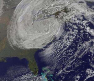
Ferocious — Superstorm Sandy over the Northeast coast, October 2012 satellite image. It was the largest Atlantic hurricane in recorded weather history — with tropical-storm-force winds that spanned nearly 1,200 miles.
Sea Bright
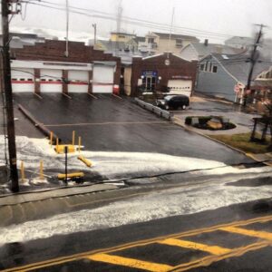
Coming Thru — View of the Sea Bright municipal area on Ocean Avenue before the full force of Superstorm Sandy, October 2012 (PJ Covert Photo).
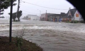
Running Water — the fury of Superstorm Sandy is evident on Ocean Avenue, October 2012.
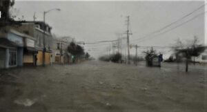
Ocean Avenue — literally, October 2012. Looking north on Sea Bright’s main boulevard at the height of Superstorm Sandy (RedBankGreen Photo).
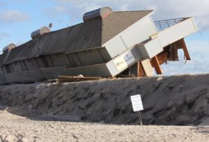
Driftwood Beach Club cabanas were uprooted during Sandy, December 2012 (Martin Arasin Photo).
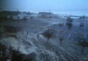
Superstorm Sandy batters the borough coast, October 2012 (Susie Markson Photo).
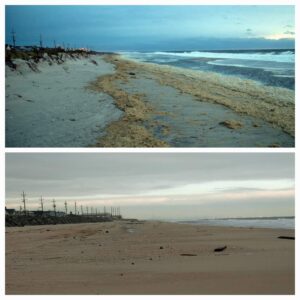
Sandy’s Impact — Coastal Comparing: Top: October 28, 2012; Bottom: November 14, 2012. Location is across from the Quay (Stanley Kosinski Photo).
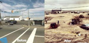
Sandy’s Impact — Coastal Comparing #2 (Susie Markson Photo).
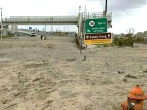
A different kind of pile -up — the state highway to Highlands and Sandy Hook is blocked with sand after Superstorm Sandy, November 2012.
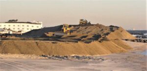
Locals dubbed it “Mount Sandy,” November 2012. For weeks it was a stark reminder of Superstorm Sandy’s devastating impact on Sea Bright. It’s estimated that 100,000+ cubic yards of sand was dumped here while the borough recovered (RedBankGreen Photo).
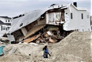
Sea Bright Mayor Dina Long inspects Superstorm Sandy damage along the borough coast, November 2012. “The town was entirely unlivable for at least a month,” said Mayor Long in a Philadelphia magazine 10-year retrospective on Sandy. She called the storm ” a dividing line in my life.”
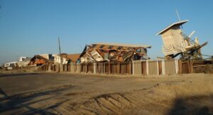
Superstorm Sandy damage, November 2012 (Nick Lenczyk Photo).
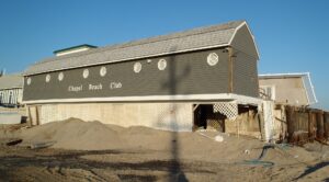
Chapel Beach Club on Ocean Avenue after Sandy, November 2012 (Nick Lenczyk Photo).
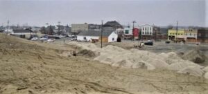
Sea Bright’s sand mountain after Superstorm Sandy, November 2012.
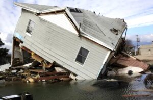
Superstorm Sandy damage, November 2012.
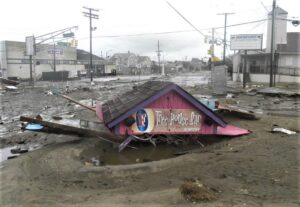
Damage remains from Superstorm Sandy, November 2012.

NJ Gov. Chris Christie, Mayor Dina Long and Councilman C. Read Murphy assess storm damage from Sandy in Sea Bright, November 2012 (RedBankGreen Photo).
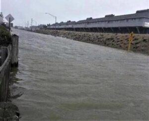
Ocean Avenue during Superstorm Sandy, October 2012.
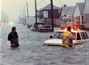
Superstorm Sandy flooding on Ocean Avenue, October 2012.
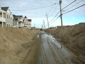
Ocean Avenue in North Beach after Sandy, November 2012 (Nick Lenczyk Photo).
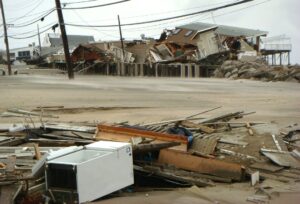
Superstorm Sandy aftermath, November 2012.
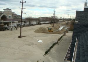
Ocean Avenue looking south, November 2012 (Nick Lenczyk Photo).
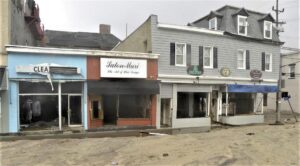
Ocean Avenue storefronts blasted by Superstorm Sandy, November 2012.
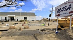
J.W. Ross Library after Superstorm Sandy, November 2012.
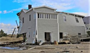
Superstorm Sandy damages, November 2012.
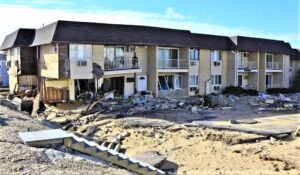
Damage remains from Superstorm Sandy, November 2012.
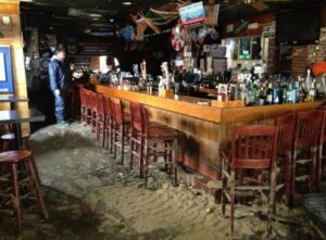
Last Call — Sandy wrecked a local bar, November, 2012 (Susie Markson Photo).
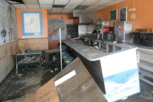
Over Done — “Steve’s Breakfast & Lunch” on Ocean Avenue after Superstorm Sandy, November 2012.
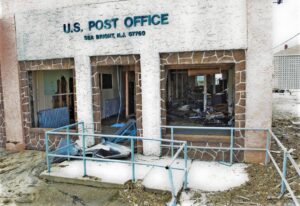
US Post Office at Sea Bright gutted by Superstorm Sandy, November 2012.
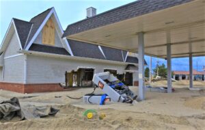
The borough’s only gas station was lost during Superstorm Sandy, November 2012.
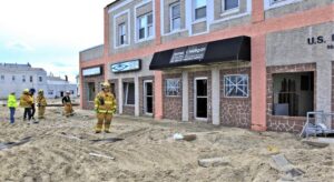
Damage remains from Superstorm Sandy, November 2012.
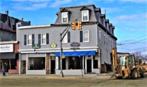
Ocean Avenue after Superstorm Sandy, November 2012.
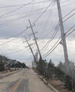
Telephone-power poles along Ocean Avenue took the brunt of Sandy’s 75-MPH winds, 2012.
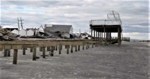
Sandy did a real number on all borough beach clubs, November 2012.
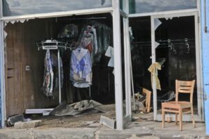
Cleaned Out — Sea Bight Dry Cleaners on Ocean Avenue in ruins after Sandy, November 2012.
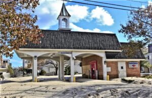
The Bank of America branch surrounded by storm debris after Sandy, November 2012.
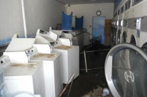
Extra Wash — Sea Bright Laundromat on Ocean Avenue in ruins after Superstorm Sandy, November 2012 (Steve Gardella Photo).
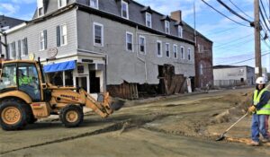
Superstorm Sandy damage along Ocean Avenue, November 2012.
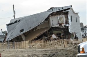
Superstorm Sandy damage, November 2012.
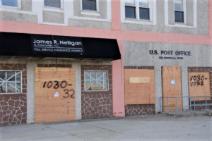
Boarded up after Superstorm Sandy, November 2012.
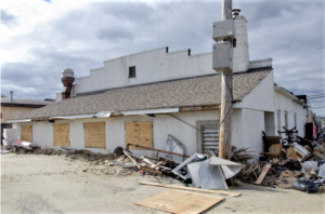
Superstorm Sandy damage, November 2013.
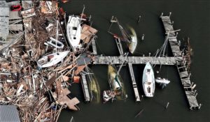
Borough boat business took a major hit from Sandy’s furies, November 2012.
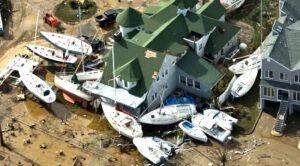
More Sandy damage to borough boats and buildings, November 2012.
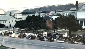
Ocean Avenue homeowners piled up their Sandy junk, November 2012.
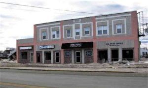
Businesses along Ocean Avenue after Superstorm Sandy, November 2012.
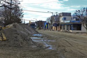
Muck & Mud — Ocean Avenue looking south after Sandy, November 2012.
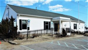
Jay W. Ross Library & Arts Center on Ocean Avenue, 2013. Opened in 1992, it was badly damaged during Superstorm Sandy.
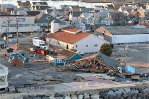
Donovan’s Reef in ruins after Superstorm Sandy, November 2012 (StansPhotos.com). The popular beach bar hangout reopened after repairs in June 2017. The business dates to 1976.
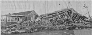
Donovan’s Reef — nothing but timber after Superstorm Sandy, November 2012.
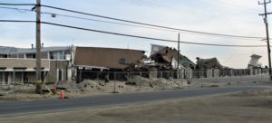
Hurricane Sandy damage on Ocean Avenue, 2012.
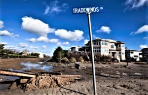
Ocean Avenue after Sandy, November 2012.
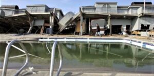
Driftwood Beach Club damages after Hurricane Sandy, January 2013.
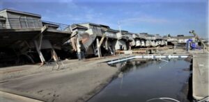
Driftwood Beach Club damages after Hurricane Sandy, January 2013.
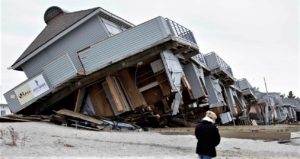
Driftwood Beach Club damages after Superstorm Sandy, November 2012.
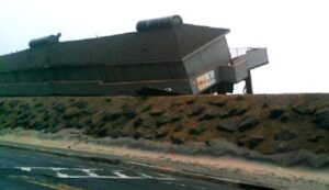
Driftwood Beach Club took a real pounding from Superstorm Sandy, December 2012.
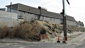
It bent but didn’t break — Driftwood Beach Club damage post Sandy, November 2012.
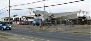
Ship Ahoy Beach Club storm damages, 2013. Like all town beach clubs, members and owners looked upon ruin after Superstorm Sandy, November 2012.
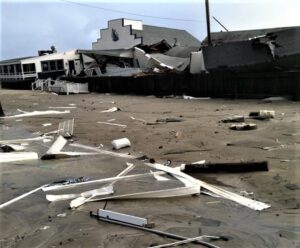
Ship Ahoy after Sandy storm damage, November 2012. Otto “Skipper” Gillig opened the private club on Ocean Avenue in 1936.
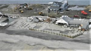
Ship Ahoy club damage remains after Superstrom Sandy, November 2012.
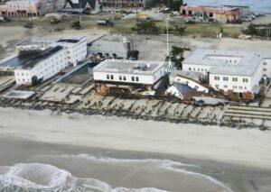
Seabrigth Beach Club damage after Sandy, November 2012.
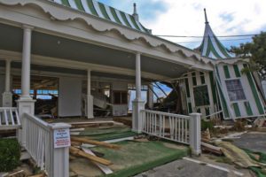
Seabright Beach Club after Sandy, November 2012.
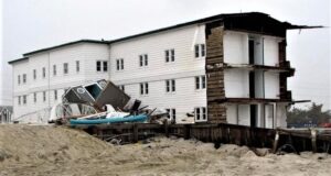
Seabright Beach Club after Superstorm Sandy, November 2012.
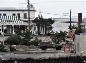
Seabright Beach Club after Hurricane Sandy, November 2012.
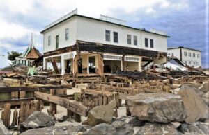
Seabright Beach Club after Superstorm Sandy, November 2012.
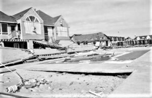
Edgewater Beach Club took a real pounding from Superstorm Sandy, 2013.
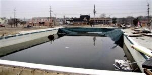
Chapel Beach Club after Superstorm Sandy, 2013.
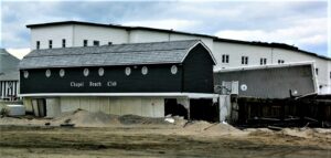
Chapel Beach Club after Hurricane Sandy damage, November 2012.
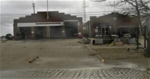
Getting Clobbered — municipal buildings during Superstorm Sandy, October 2012.
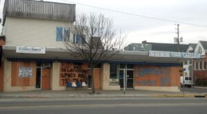
Ocean Avenue businesses boarded-up after Sandy storm damage, November 2012.
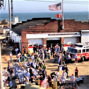
Sea Bright firehouse became a “First Responder” refuge in the days after Superstorm Sandy, November 2012.
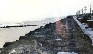
The Sea Bright seawall looking south — mostly wiped clean by Superstorm Sandy, November 2012.
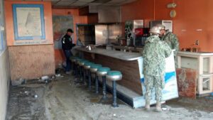
Many popular spots in Sea Bright — like “Steve’s Breakfast & Lunch” — would never reopen after Superstorm Sandy, November 2012.
Monmouth Beach
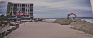
The borough of Monmouth Beach preps for the coming storm at the MBBP, October 2012.
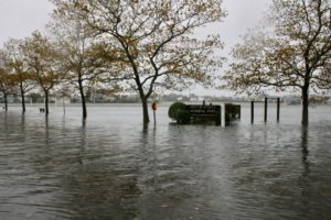
Griffin Park flooding during Sandy, October 2012.
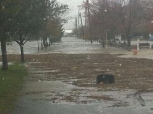
Flooding along Monmouth Parkway in Shorelands during Sandy, October 2012.
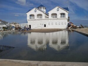
MBBP pool area after Superstorm Sandy, November 2012 (Jack Flaherty Photo).
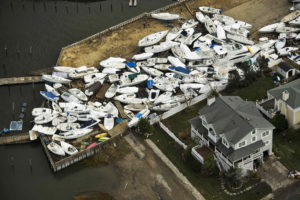
Shorelands boat mess after Superstorm Sandy, November 2012.
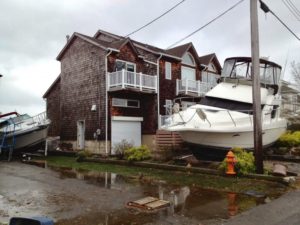
Superstorm Sandy had a devastating impact on Shorelands homes, November 2012.
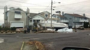
More Shorelands damage from Superstorm Sandy, November 2012.
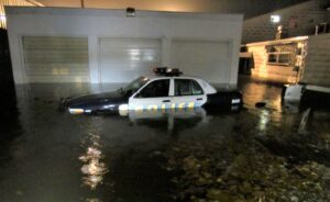
MBPD patrol car caught in Sandy storm surge, October 2012.
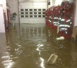
Sandy flood waters in the Monmouth Beach firehouse, October 2012.
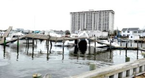
Channel Club Tower area after Superstorm Sandy, November 2012 (Jack Flaherty Photo). The docks have been uprooted.
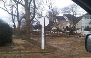
Superstorm Sandy damage at River Avenue and Johnson Street, November 2012.
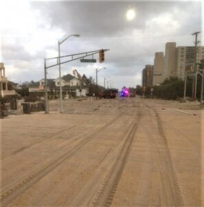
Ocean Avenue looking north after Superstorm Sandy, November 2012. (MBFD Photo).
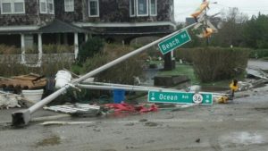
Beach Road-Ocean Avenue road sign and traffic light after Sandy, November 2012.
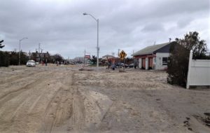
Superstorm Sandy aftermath on Ocean Avenue, November 2012.
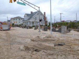
Ocean Avenue after Superstorm Sandy, November 2012.
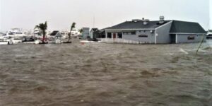
Salle Tee’s Grille surrounded by Superstorm Sandy flooding, October 2012 (MBFD Photo).
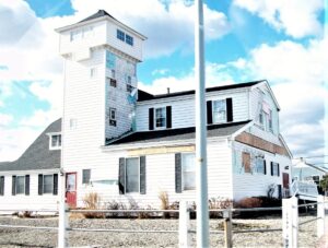
MB Cultural Center after Superstorm Sandy, November 2012.
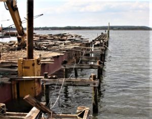
Dock damage at Channel Club Marina after Superstorm Sandy, January 2013.
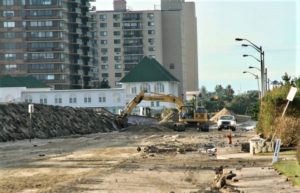
Monmouth Beach Bath & Tennis Club on Ocean Avenue after Superstorm Sandy, November 2012. Known around town as “The Club” — it opened in 1910.
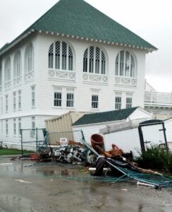
MB Club after Superstorm Sandy, November 2012. The main building itself suffered only minor damage (having refortified with a $3 million renovation in 2007) but its out-buildings were another story.
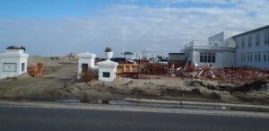
MB Club entrance on Ocean Avenue after Superstorm Sandy, November 2012.
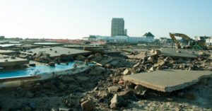
The Club’s numerous northern bathhouses/cabanas were leveled flat by Sandy’s natural forces, November 2012.
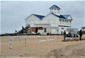
MBBP damage after Superstorm Sandy, November 2012 (MBFD Photo).
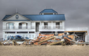
MBBP damage after Superstorm Sandy, November 2012.
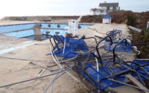
MBBP damage after Superstorm Sandy, November 2012.
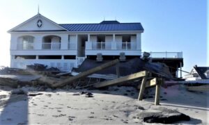
MBBP damage after Superstorm Sandy, November 2012.
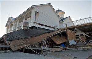
MBBP damage after Superstorm Sandy, November 2012.
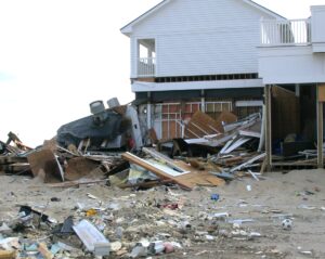
MBBP damage after Superstorm Sandy, November 2012.
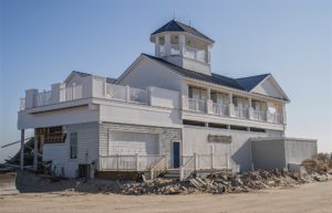
MBBP damage after Superstorm Sandy, November 2012.
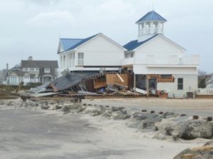
MBBP damage after Superstorm Sandy, November 2012.
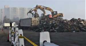
MBBP parking lot served as town dump after Superstorm Sandy, December 2012 (MAC Photography).
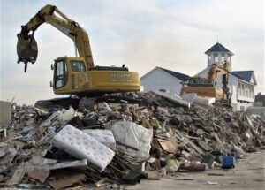
MBBP parking lot becomes town dump site after Superstorm Sandy, December 2012.
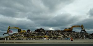
MBBP parking lot after Superstorm Sandy, November 2012.
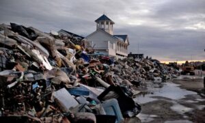
MBBP parking lot after Superstorm Sandy, December 2012.
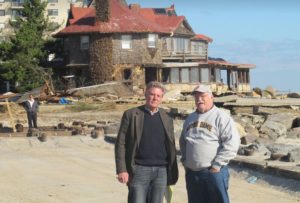
US Congressman Frank Pallone, Jr. and Borough Commissioner Jim Cunniff inspecting storm damage at the MBBP after Sandy, November 2012.
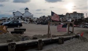
Some MBBP patriotism after Superstorm Sandy, November 2012.
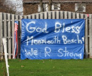
One borough family was grateful for surviving Sandy, December 2012.
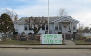
Another family spelled out some ground rules after Sandy, December 2012.
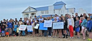
MBBP celebrates a post-Superstorm Sandy opening, May 2013.
Long Branch
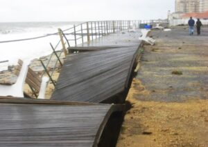
The Long Branch boardwalk took a pounding from Superstorm Sandy, November 2012.
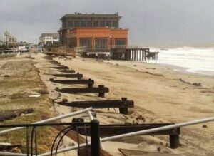
Long Branch boardwalk sections were blown off their foundation during Superstorm Sandy, October 2012.
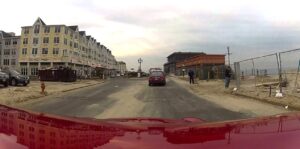
Pier Village is ghostly quiet after Sandy, November 2012.
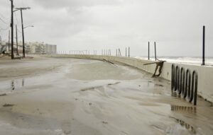
Sandy hitting North End, October 2012 (Jennifer Stiles Photo).
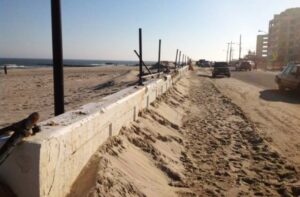
North End after Superstorm Sandy, November 2012.
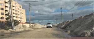
Avenel Blvd in North End after Superstorm Sandy, November 2012.
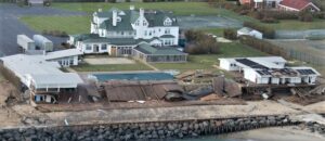
Ocean Beach Club on Ocean Avenue after Superstorm Sandy, November 2013.
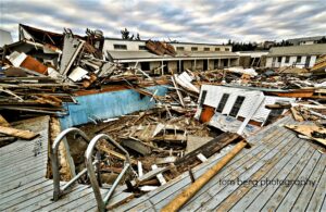
Elberon Bathing Club in ruins after Superstorm Sandy, November 2013 (Tom Berg Photo).
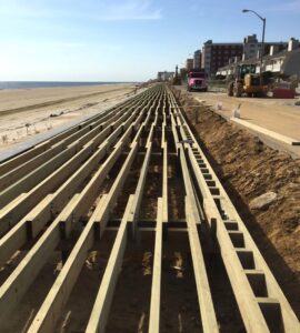
Long Branch boardwalk near Bath Avenue gets major improvements, October 2015. This boardwalk reconstruction project — the largest in city public works history — cost $24 million. Long Branch had lost nearly a mile section of the boardwalk to damage during Superstorm Sandy in October 2012.
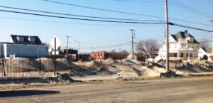
Superstorm Sandy damage in North End, November 2013.
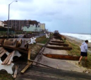
Superstorm Sandy damage to Long Branch boardwalk, November 2012.


